
 Image 1 of 3
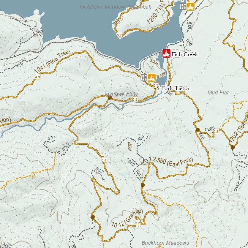 Image 2 of 3
 Image 3 of 3
This map was designed for use on Avenza or other GeoPDF reader: text sizes and line widths are optimized for users who have zoomed in on the trails they are riding. It has all of the groomed snowmobile trails, identified ungroomed routes, trail access/Sno-Parks and winter facilities in Yakima County South of US-12, including Ahtanum State Forest and the South Fork Tieton/Rimrock Lake area. The map also shows the 4x4 trails often used by snowmobilers, Nordic trails and other summer trails. It includes trails from Rattlesnake, Tieton Airstrip, Bear Creek, Cold Creek, Ahtanum Meadows and Ahtanum Guard Station Sno-Parks as well as trails from the Fish Creek Sno-Park (which is closed for the 2024-2025 season.) The map was updated for the 2024-2025 season (including closed Sno-Parks). The map scale is 1:60,000.
This map was designed for use on Avenza or other GeoPDF reader: text sizes and line widths are optimized for users who have zoomed in on the trails they are riding. It has all of the groomed snowmobile trails, identified ungroomed routes, trail access/Sno-Parks and winter facilities in Yakima County South of US-12, including Ahtanum State Forest and the South Fork Tieton/Rimrock Lake area. The map also shows the 4x4 trails often used by snowmobilers, Nordic trails and other summer trails. It includes trails from Rattlesnake, Tieton Airstrip, Bear Creek, Cold Creek, Ahtanum Meadows and Ahtanum Guard Station Sno-Parks as well as trails from the Fish Creek Sno-Park (which is closed for the 2024-2025 season.) The map was updated for the 2024-2025 season (including closed Sno-Parks). The map scale is 1:60,000.