
 Image 1 of 3
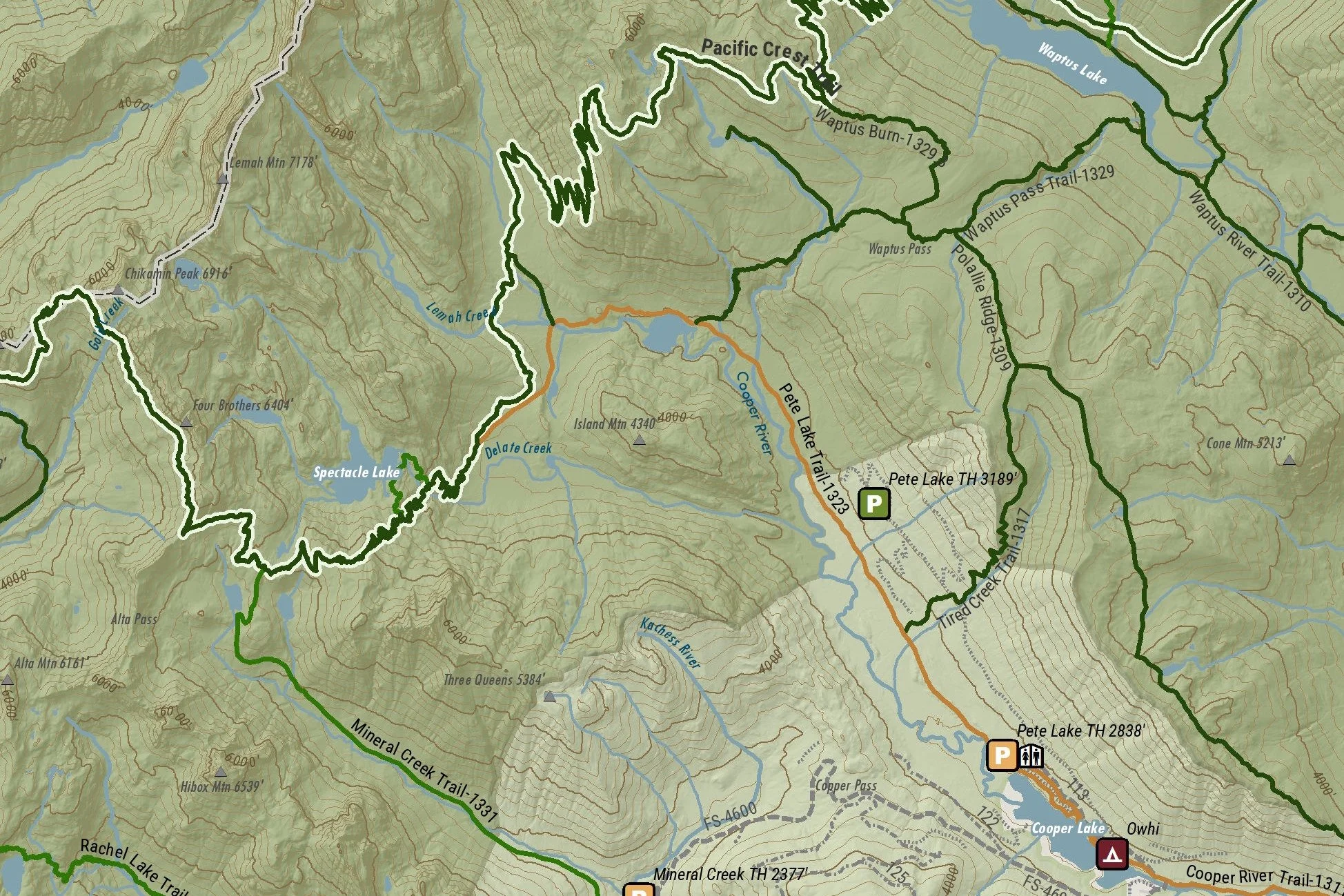 Image 2 of 3
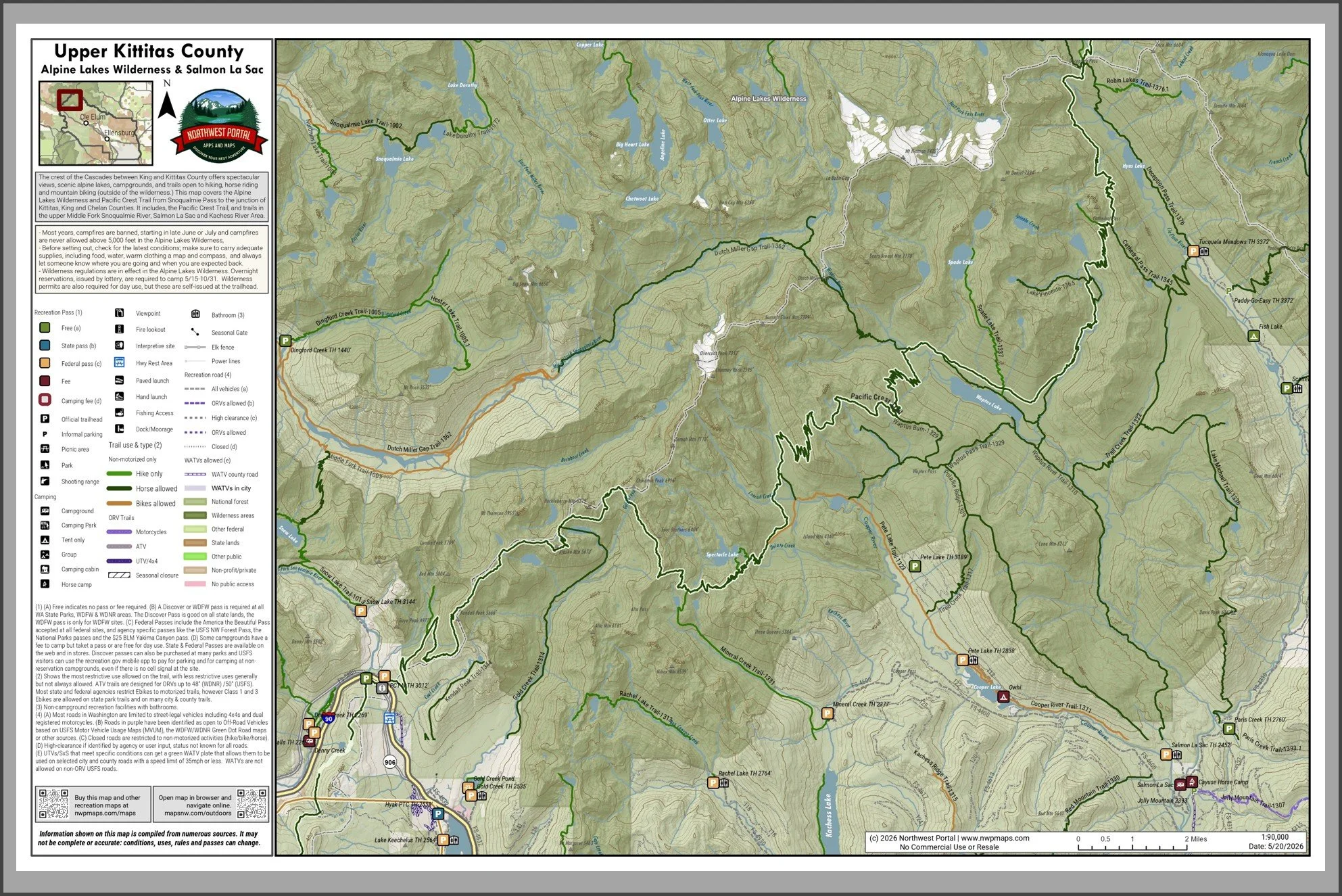 Image 3 of 3
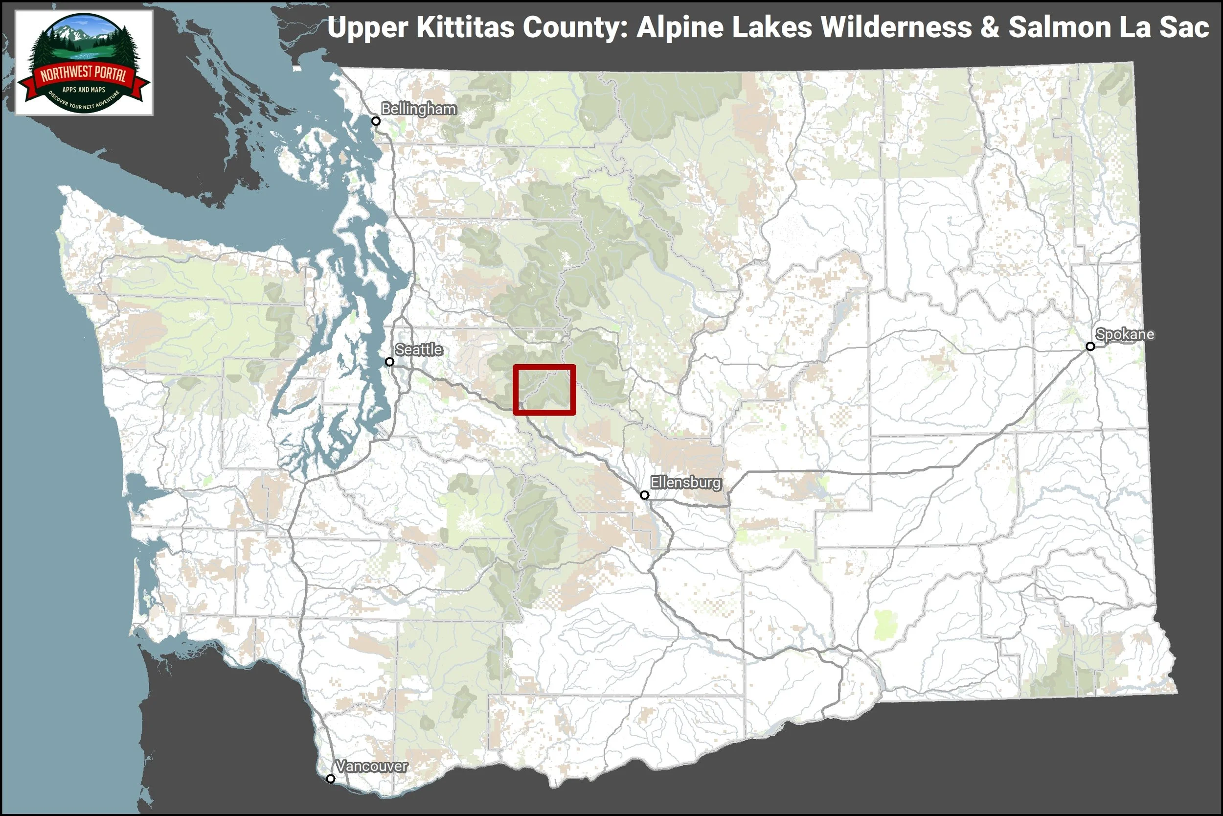
This tabloid sized (11×17”) map covers the Alpine Lakes Wilderness and Pacific Crest Trail from Snoqualmie Pass to the junction of Kittitas, King and Chelan Counties. It includes, the Pacific Crest Trail, and trails in the upper Middle Fork Snoqualmie River, Salmon La Sac and Kachess River areas. The map is at a scale of 1:90,000 and includes campgrounds and trails open to hikers, horseback riders and mountain bikers. Popular trails in the map area include the Kendall Catwalk on the Pacific Crest Trail, Pete Lake, Cooper River, Waptus River, Pollalie and the Middle Fork and Dutch Miller along the Middle-Fork Snoqualmie River in King County.
This map is part of the Northwest Portal recreation mapping project. The maps pull together summer and year-round recreation opportunities managed by all agencies into a single place. Each map is configured to showcase a popular recreation destination, with scales ranging from 1:24,000-1:140,000 to capture the full area. The information is presented so people can see what is most important at a glance: recreation facilities are color coded by the recreation pass that is needed for parking, trails and roads are color coded by the activities that are allowed, and recreation lands show who manages them. The information on the map is updated regularly.