Northwest Portal Maps
Discover and navigate your next adventure!
PDF maps of selected areas and activities that you can download and print or use with a GeoPDF reader.
Interactive maps that you can use in a browser.
Promotional maps that you can download and print, or pick up in the community.
Recreation maps you can use in your browser
Our free web maps are updated regularly to show seasonal and emergency closures. Plot your location with gps, use the filters and search function to find the perfect destination.
outdoors —- winter —- off-roading — dogs —- boating
Maps for Sale
PDF & Print Maps
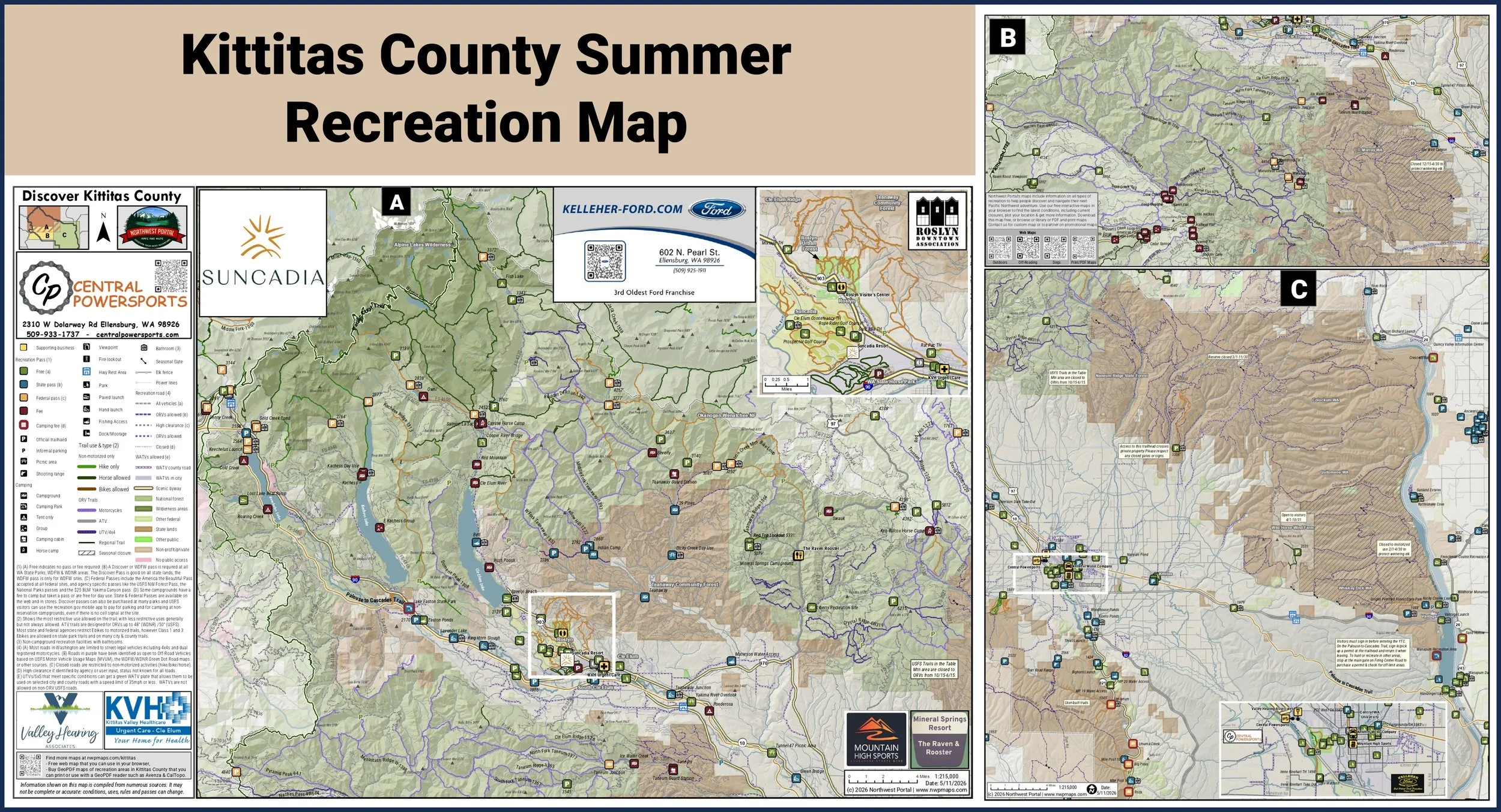
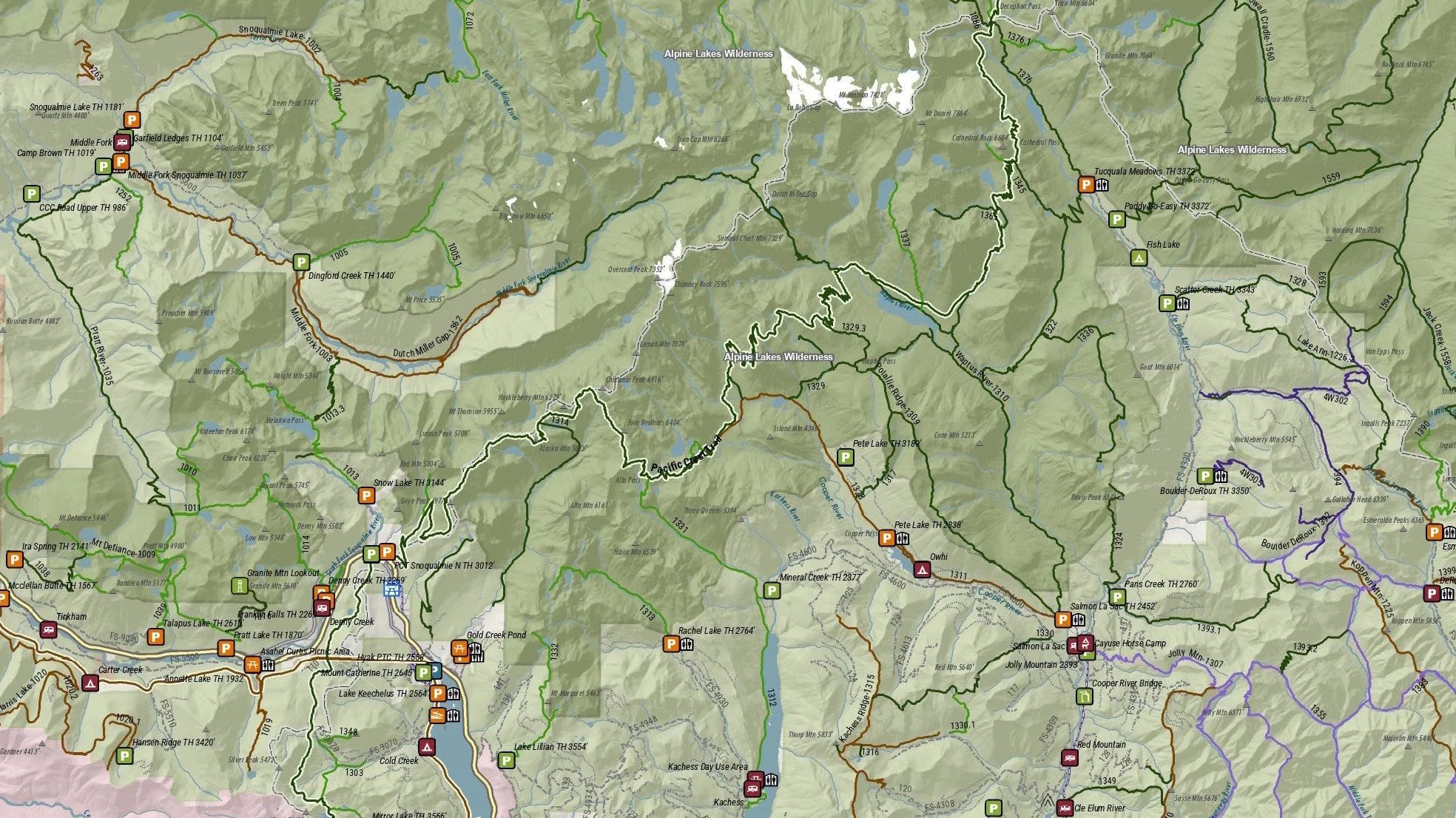
Northwest Portal’s maps are designed for you to download and print or use on your mobile device with a GeoPDF reader such as Avenza or CalTopo. Maps are available in Tabloid (11×17”) or Poster (24×36”) size, and are designed so you can quickly find all of the information that you need to plan your trip. Recreation access and facilities are color coded to show which recreation pass, if any, is required; trails and roads are color coded by the allowed uses; and recreation lands are color coded so you can see who the manager is and if they have special restrictions (such as wilderness areas or seasonal closures.)
Find maps by activity or area. If you would like a new map added to the library, let us know.
Activities


Areas
Summer maps
Winter Maps
Advertiser supported maps
Free to download or pick up a copy around town.
With the support of local businesses, Northwest Portal can produce a printed map that can be handed out throughout your community.
Contact us if you would like printed copies of the Kittitas County maps to hand out, if you want to be on the 2027 Kittitas County map or if you would like to partner with us on a map for your community.