
 Image 1 of 5
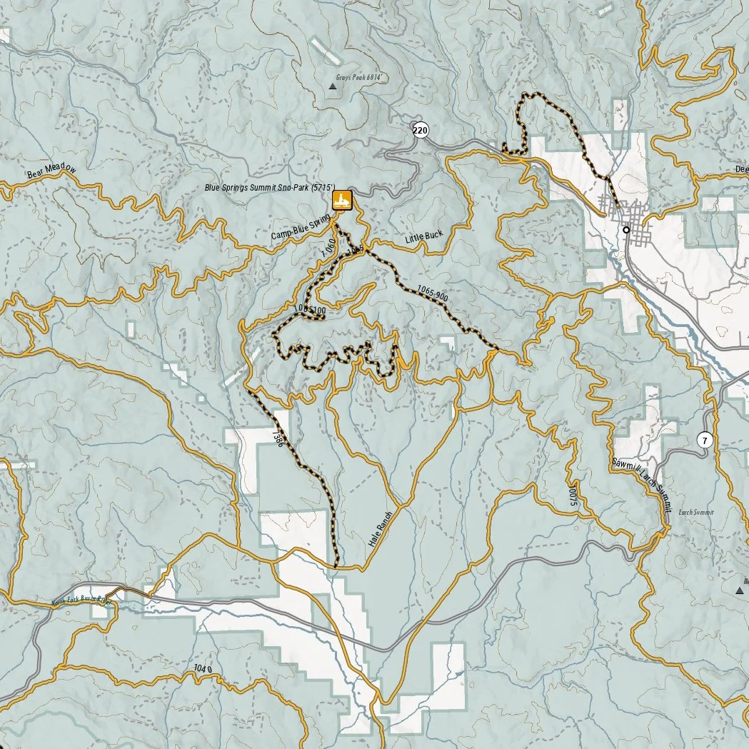 Image 2 of 5
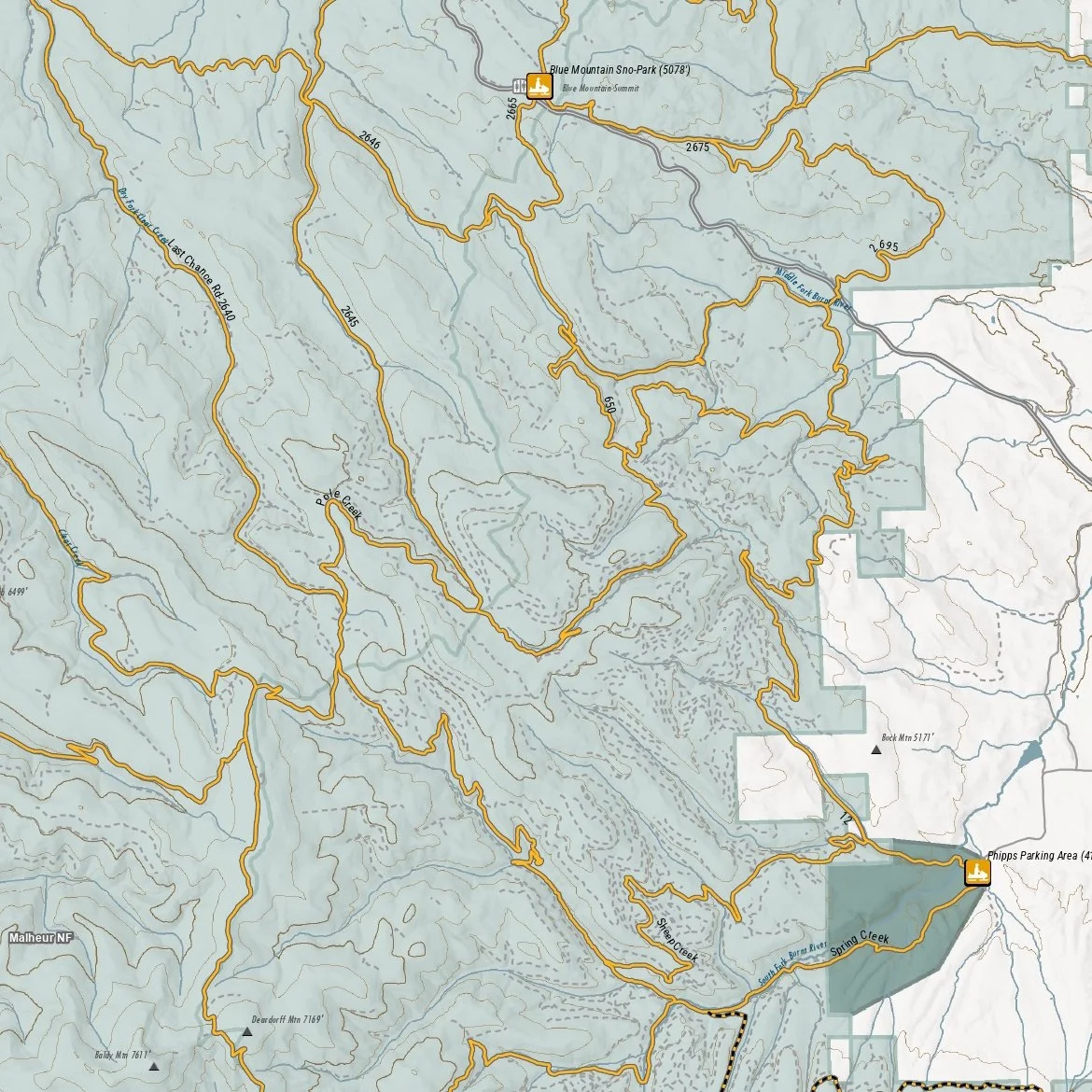 Image 3 of 5
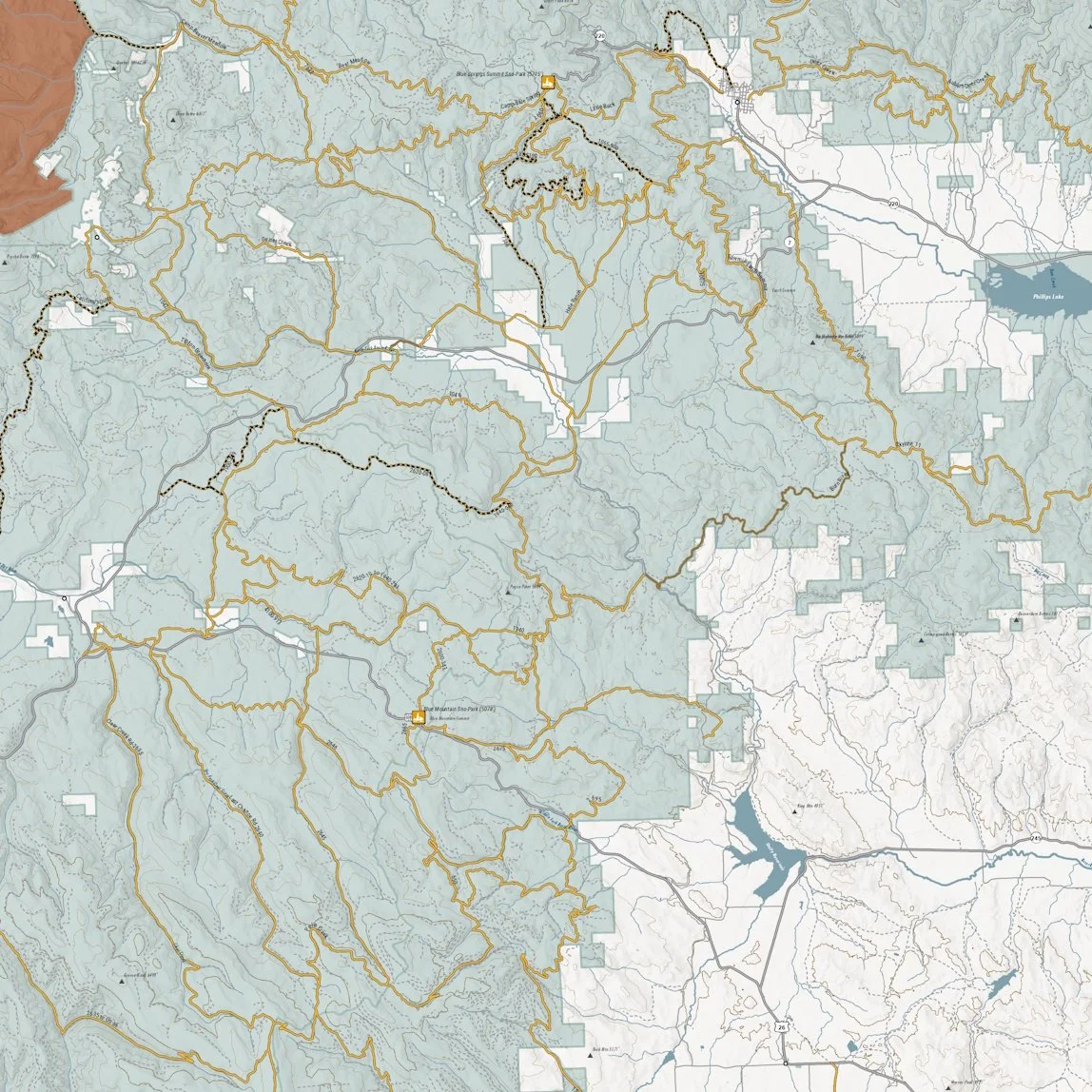 Image 4 of 5
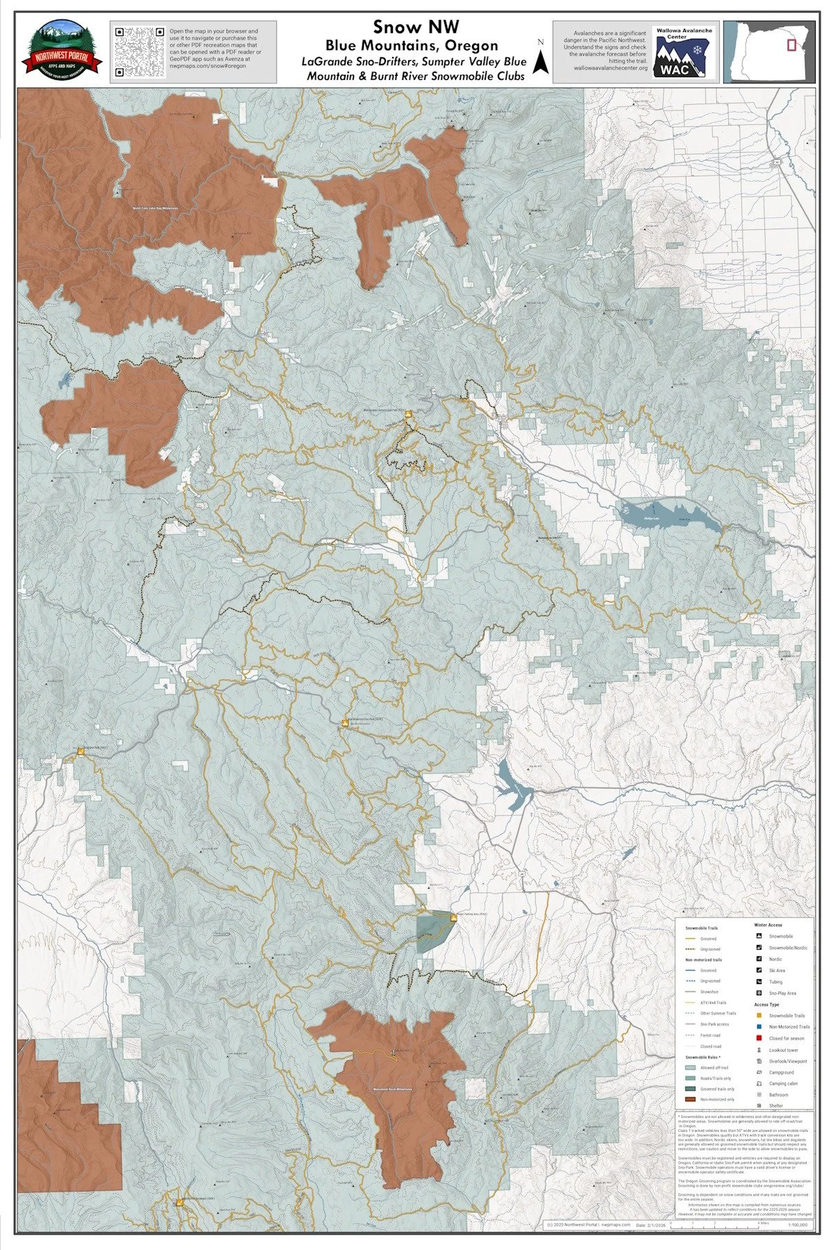 Image 5 of 5
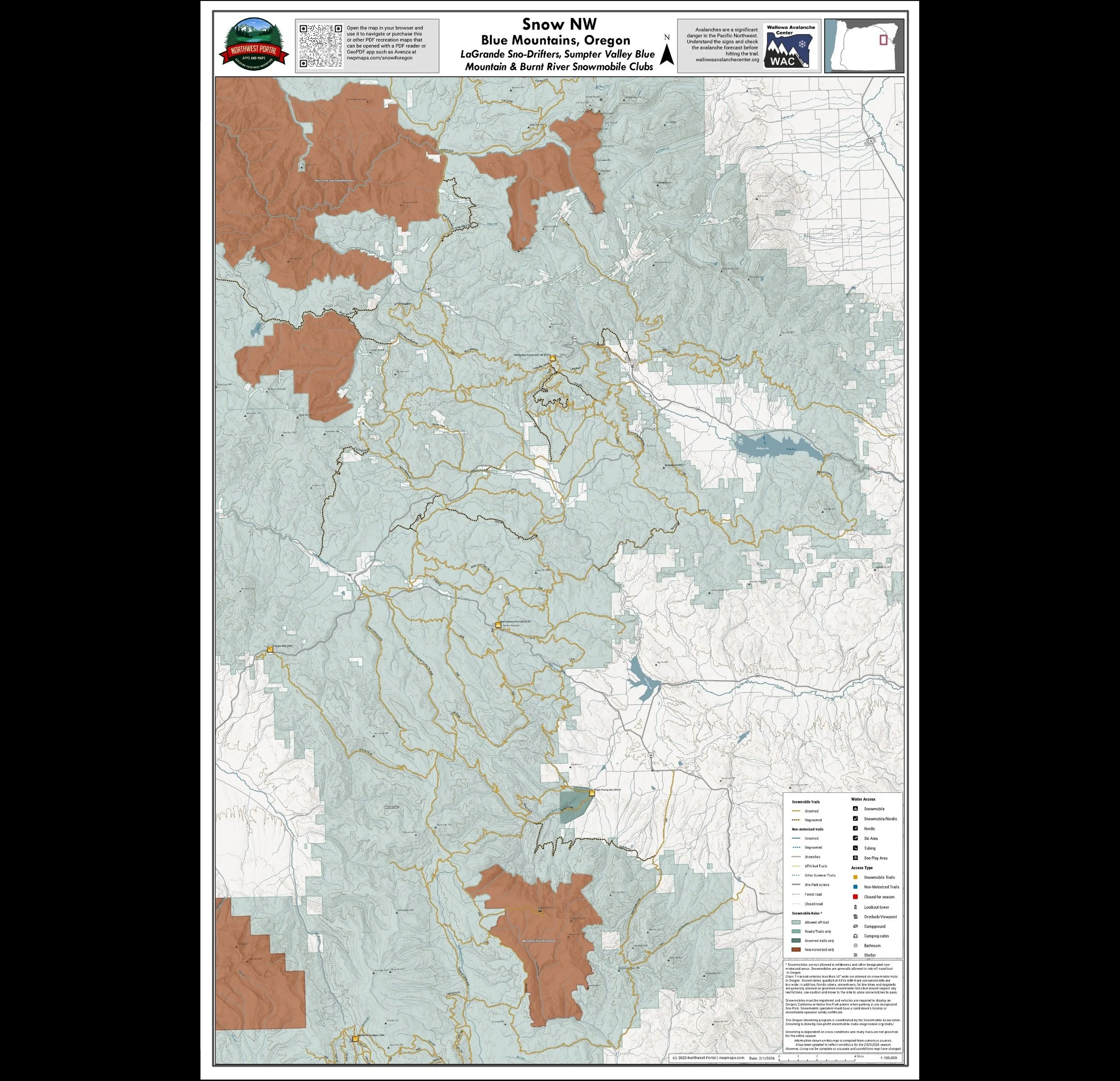
This map shows winter trails in Oregon’s Blue Mountains that are groomed by the LaGrande Sno-Drifters, Sumpter Valley Blue Mountain Snowmobile Club & Burnt River Snowmobile Clubs. It is part of a series of winter recreation map that show where you can ride your sled, ski or snowshoe in the Pacific Northwest. See which trails are groomed, what areas snowmobiles are allowed and where they are restricted. The maps, which were updated for the 2025-2026 season, include shelters, campgrounds, viewpoints, fire towers as well as summer trails and recreation roads, that are often utilized for winter recreation. This map shows trails served by the Blue Mountain, Blue Springs Summit, Grande Ronde, Meacham Divide/Mt.Emily Dixie and Philips Sno-Parks. The map includes areas in the Wallowa Whitman, Malheur and Umatilla National Forests in Baker, Grant and Union Counties. It is a poster sized (24x36”) PDF at a 1:100,000 scale that you can print or use with a GeoPDF app such as Avenza.
This map shows winter trails in Oregon’s Blue Mountains that are groomed by the LaGrande Sno-Drifters, Sumpter Valley Blue Mountain Snowmobile Club & Burnt River Snowmobile Clubs. It is part of a series of winter recreation map that show where you can ride your sled, ski or snowshoe in the Pacific Northwest. See which trails are groomed, what areas snowmobiles are allowed and where they are restricted. The maps, which were updated for the 2025-2026 season, include shelters, campgrounds, viewpoints, fire towers as well as summer trails and recreation roads, that are often utilized for winter recreation. This map shows trails served by the Blue Mountain, Blue Springs Summit, Grande Ronde, Meacham Divide/Mt.Emily Dixie and Philips Sno-Parks. The map includes areas in the Wallowa Whitman, Malheur and Umatilla National Forests in Baker, Grant and Union Counties. It is a poster sized (24x36”) PDF at a 1:100,000 scale that you can print or use with a GeoPDF app such as Avenza.