
 Image 1 of 4
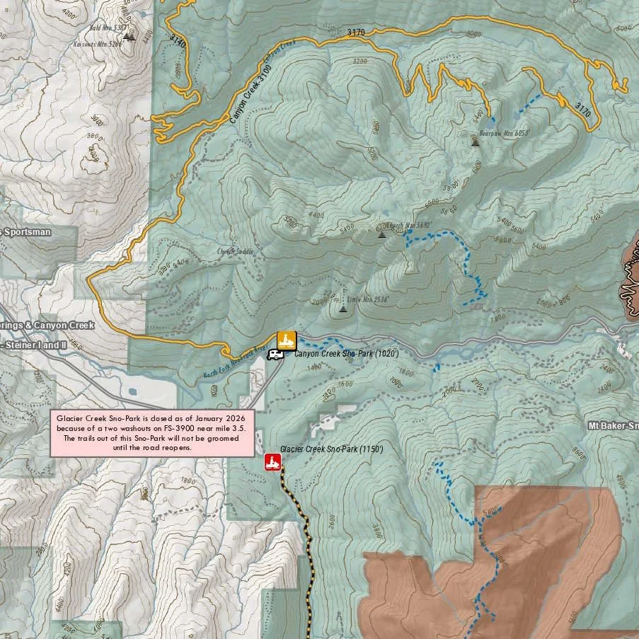 Image 2 of 4
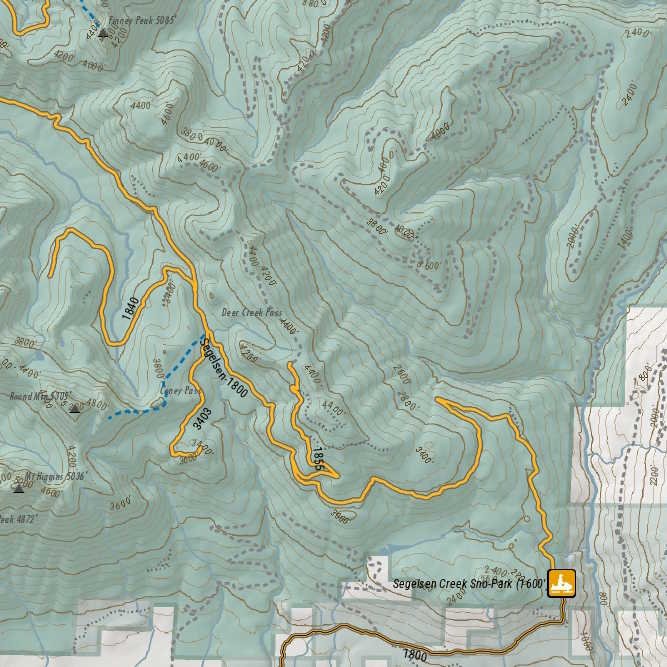 Image 3 of 4
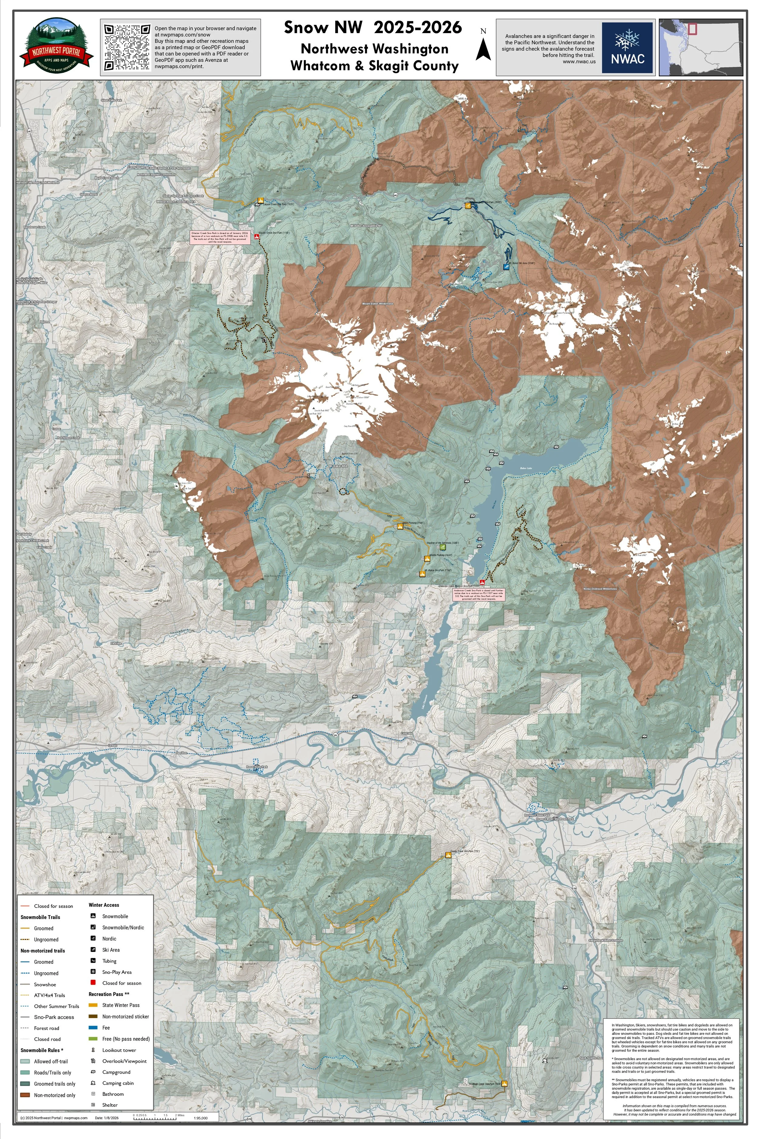 Image 4 of 4
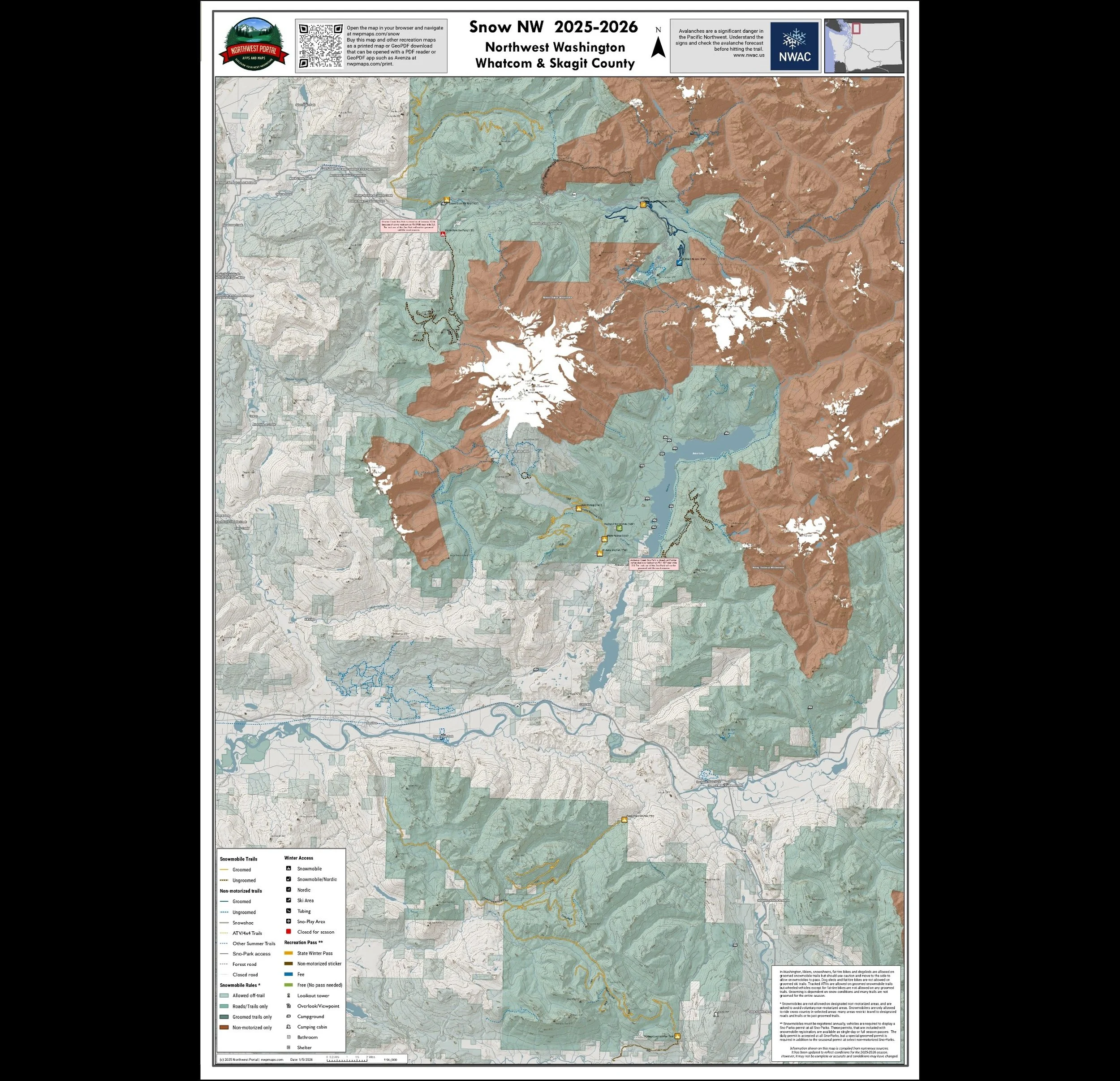
This map of winter trails in Whatcom and Skagit County, Washington is part of a series of winter recreation map that show where you can ride your snowmobile, ski or snowshoe in the Pacific Northwest. See which trails are groomed, what areas snowmobiles are allowed and where they are restricted. The maps, which were updated for the 2025-2026 season, include shelters, campgrounds, viewpoints, fire towers as well as summer trails and recreation roads, that are often utilized for winter recreation, campgrounds. It is a poster sized sized (24x36”) GeoPDF at a 1:65,000 scale that you can print, view in your browser or use with a GeoPDF app such as Avenza. The map includes several groomed snowmobile trail systems: Whatcom County’s Canyon Creek and Mount Baker Recreation Area trails, and trails out of Skagit County’s Finney Creek and Segelsen Creek Sno-Parks.
This map of winter trails in Whatcom and Skagit County, Washington is part of a series of winter recreation map that show where you can ride your snowmobile, ski or snowshoe in the Pacific Northwest. See which trails are groomed, what areas snowmobiles are allowed and where they are restricted. The maps, which were updated for the 2025-2026 season, include shelters, campgrounds, viewpoints, fire towers as well as summer trails and recreation roads, that are often utilized for winter recreation, campgrounds. It is a poster sized sized (24x36”) GeoPDF at a 1:65,000 scale that you can print, view in your browser or use with a GeoPDF app such as Avenza. The map includes several groomed snowmobile trail systems: Whatcom County’s Canyon Creek and Mount Baker Recreation Area trails, and trails out of Skagit County’s Finney Creek and Segelsen Creek Sno-Parks.