
 Image 1 of 5
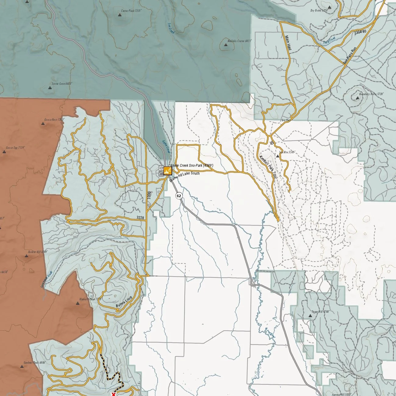 Image 2 of 5
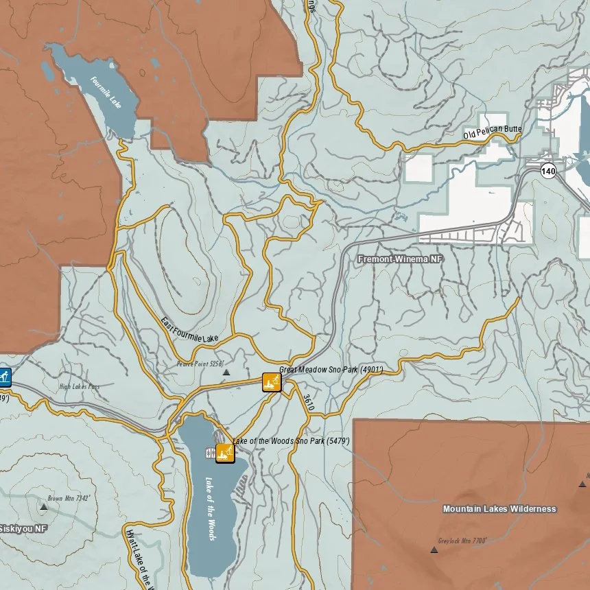 Image 3 of 5
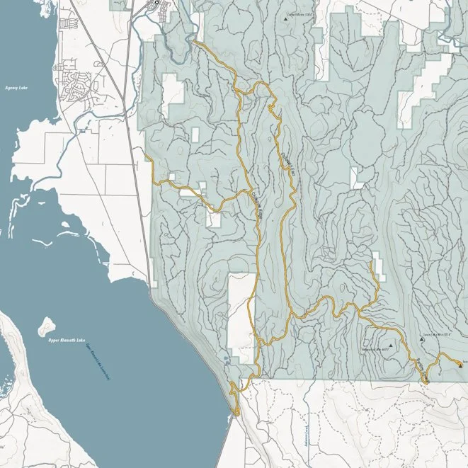 Image 4 of 5
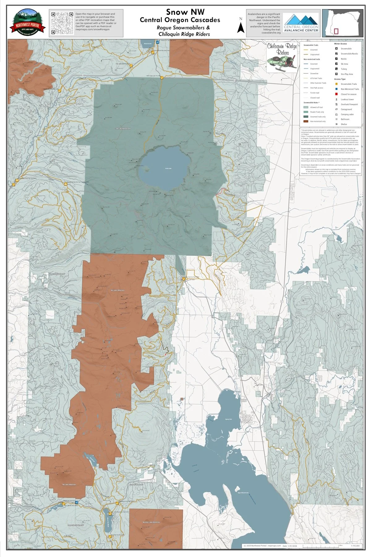 Image 5 of 5
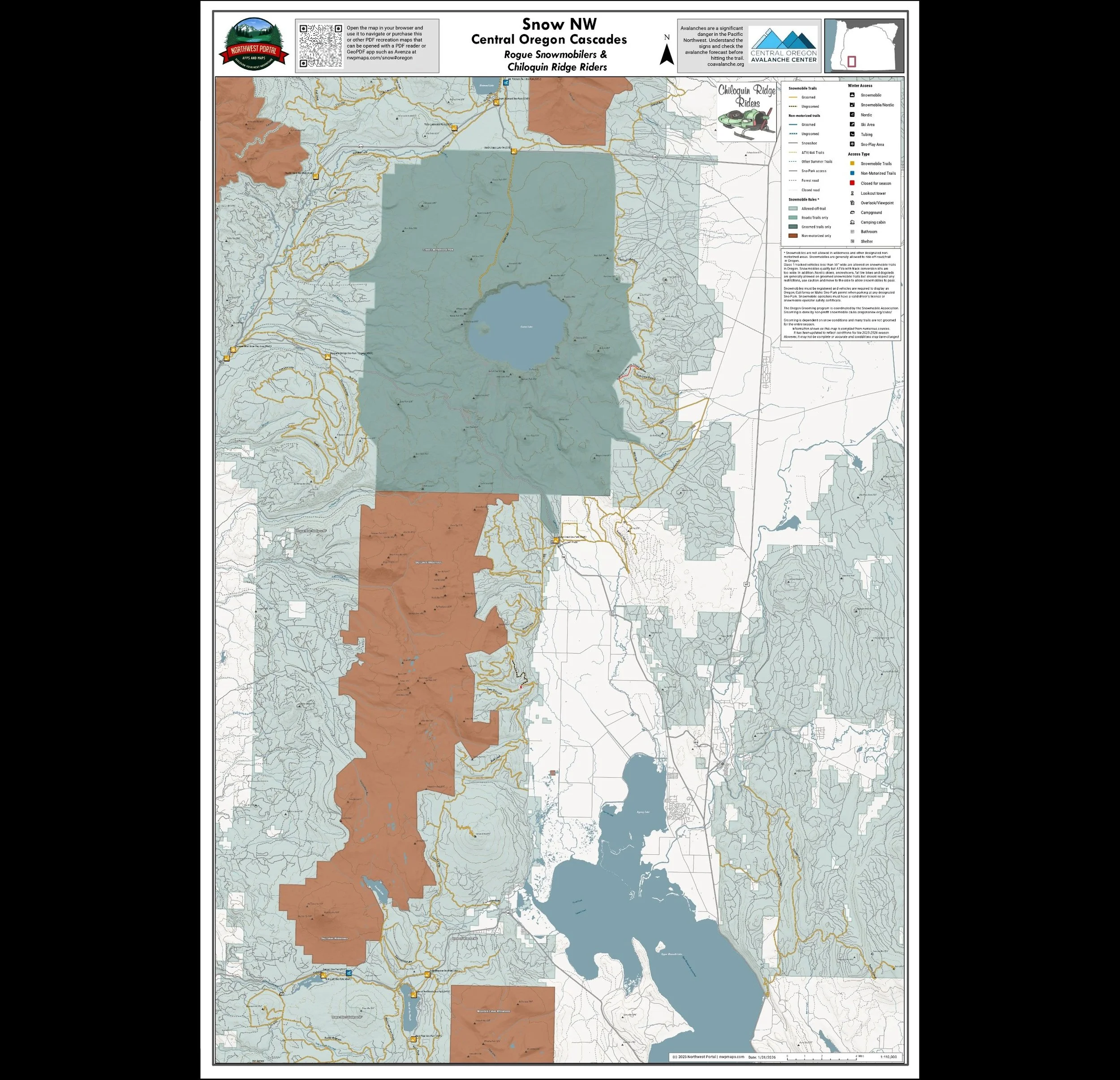
This map shows winter trails in Oregon’s Central Cascades that are groomed by the Rogue Snowmobilers & Chiloquin Ridge Riders snowmobile clubs. It is part of a series of winter recreation map that show where you can ride your sled, ski or snowshoe in the Pacific Northwest. See which trails are groomed, what areas snowmobiles are allowed and where they are restricted. The maps, which were updated for the 2025-2026 season, include shelters, campgrounds, viewpoints, fire towers as well as summer trails and recreation roads, that are often utilized for winter recreation. This map shows trails served by Three Lakes, Claude Lewis, Thousand Springs and Annie Creek Sno-Park Sno-Parks as well as trails east of Upper Klamath Lake. The map includes areas in the Rogue River-Siskiyou and Fremont-Winema National Forests in Jackson and Klamath Counties. It is a poster sized (24x36”) PDF at a 1:100,000 scale that you can print or use with a GeoPDF app such as Avenza.
This map shows winter trails in Oregon’s Central Cascades that are groomed by the Rogue Snowmobilers & Chiloquin Ridge Riders snowmobile clubs. It is part of a series of winter recreation map that show where you can ride your sled, ski or snowshoe in the Pacific Northwest. See which trails are groomed, what areas snowmobiles are allowed and where they are restricted. The maps, which were updated for the 2025-2026 season, include shelters, campgrounds, viewpoints, fire towers as well as summer trails and recreation roads, that are often utilized for winter recreation. This map shows trails served by Three Lakes, Claude Lewis, Thousand Springs and Annie Creek Sno-Park Sno-Parks as well as trails east of Upper Klamath Lake. The map includes areas in the Rogue River-Siskiyou and Fremont-Winema National Forests in Jackson and Klamath Counties. It is a poster sized (24x36”) PDF at a 1:100,000 scale that you can print or use with a GeoPDF app such as Avenza.