
 Image 1 of 4
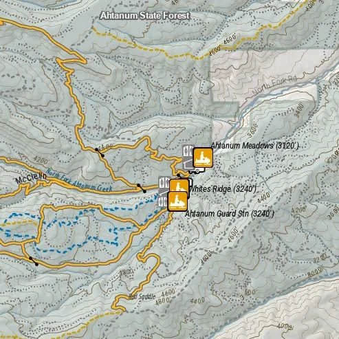 Image 2 of 4
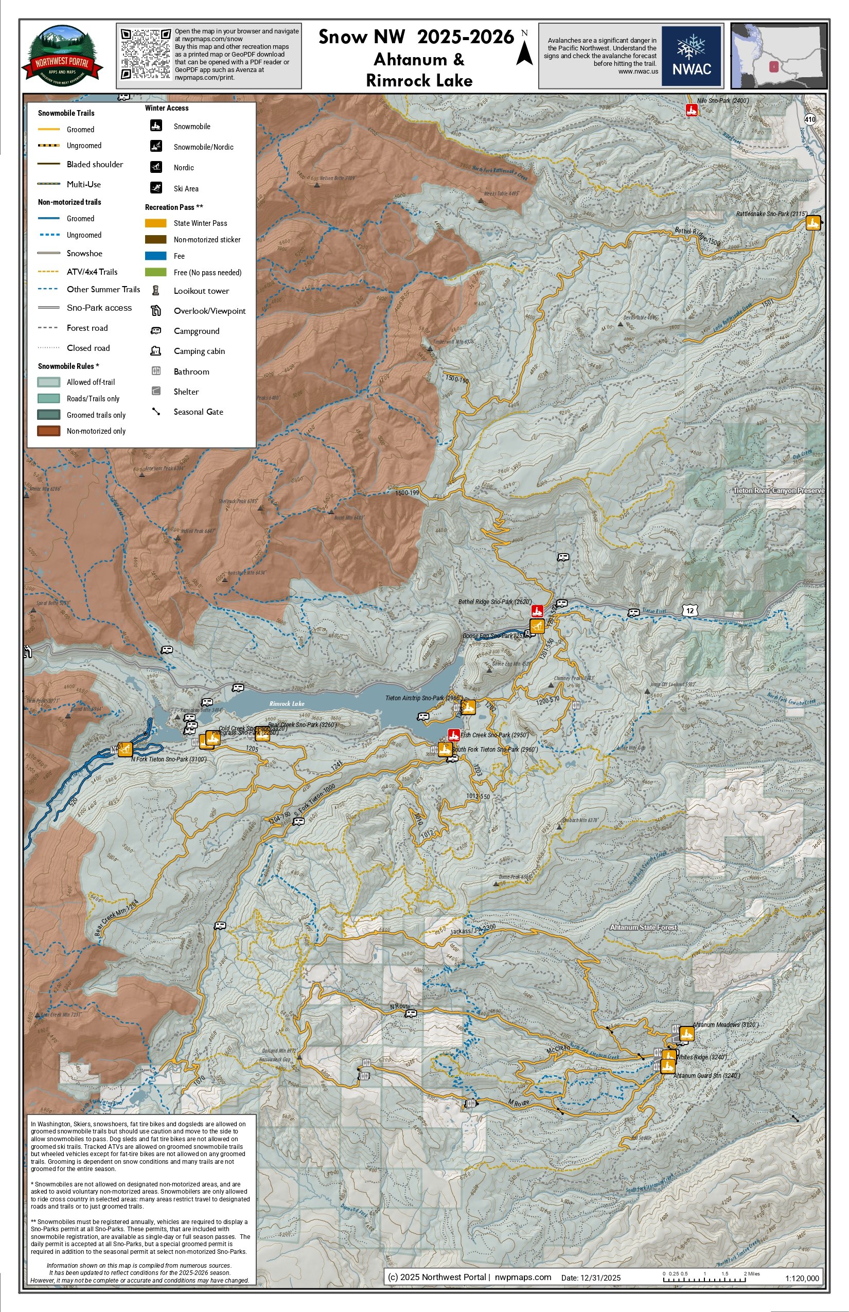 Image 3 of 4
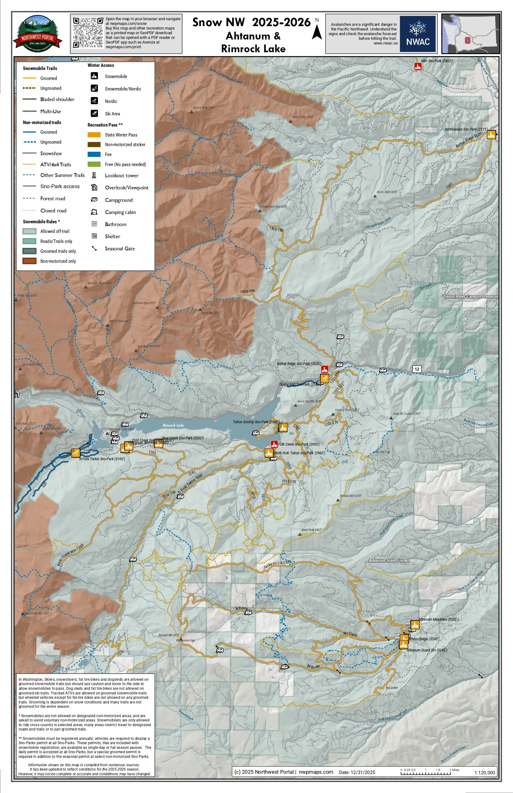 Image 4 of 4
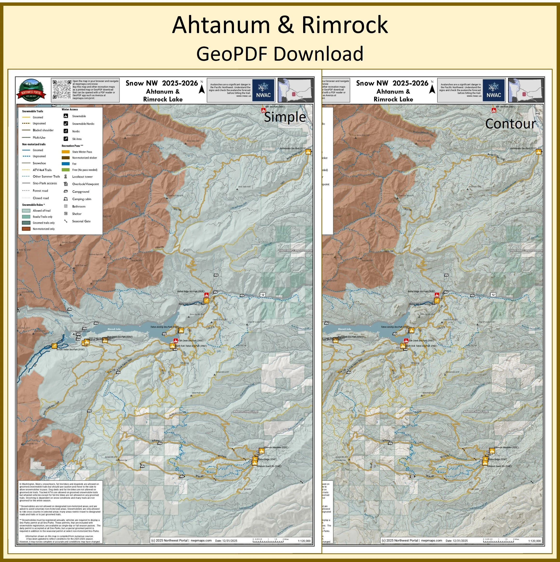
This map of winter trails in southern Yakima County, Washington is part of a series of winter recreation map that show where you can ride your sled, ski or snowshoe in the Pacific Northwest. See which trails are groomed, what areas snowmobiles are allowed and where they are restricted. The maps, which were updated for the 2025-2026 season, include shelters, campgrounds, viewpoints, fire towers as well as summer trails and recreation roads, that are often utilized for winter recreation, campgrounds. The map is a tabloid sized (11x17”) PDF at a 1:120,000 scale that you can print or use with a GeoPDF app such as Avenza. You will receive two versions of the map, one with contour lines and one without. This map includes trails from the Rattlesnake Sno-Park to Ahtanum State Forest and around Rimrock Lake.
This map of winter trails in southern Yakima County, Washington is part of a series of winter recreation map that show where you can ride your sled, ski or snowshoe in the Pacific Northwest. See which trails are groomed, what areas snowmobiles are allowed and where they are restricted. The maps, which were updated for the 2025-2026 season, include shelters, campgrounds, viewpoints, fire towers as well as summer trails and recreation roads, that are often utilized for winter recreation, campgrounds. The map is a tabloid sized (11x17”) PDF at a 1:120,000 scale that you can print or use with a GeoPDF app such as Avenza. You will receive two versions of the map, one with contour lines and one without. This map includes trails from the Rattlesnake Sno-Park to Ahtanum State Forest and around Rimrock Lake.