
 Image 1 of 5
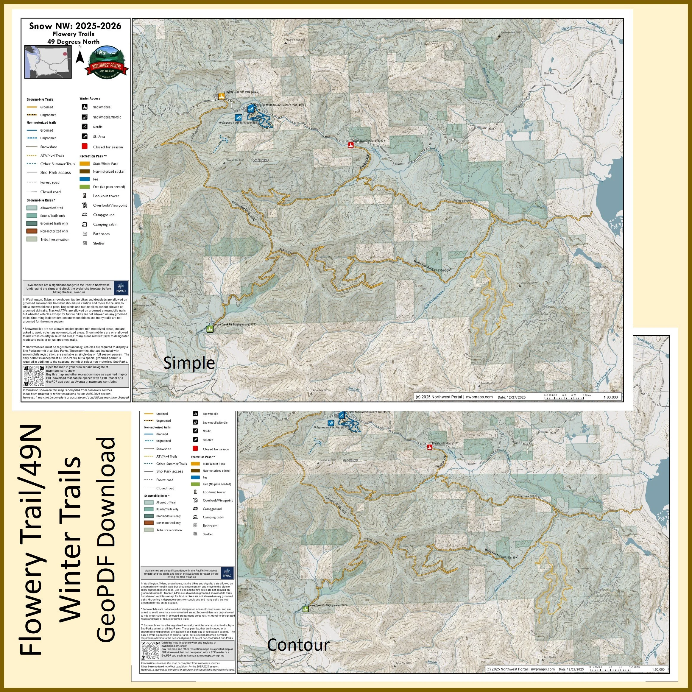 Image 2 of 5
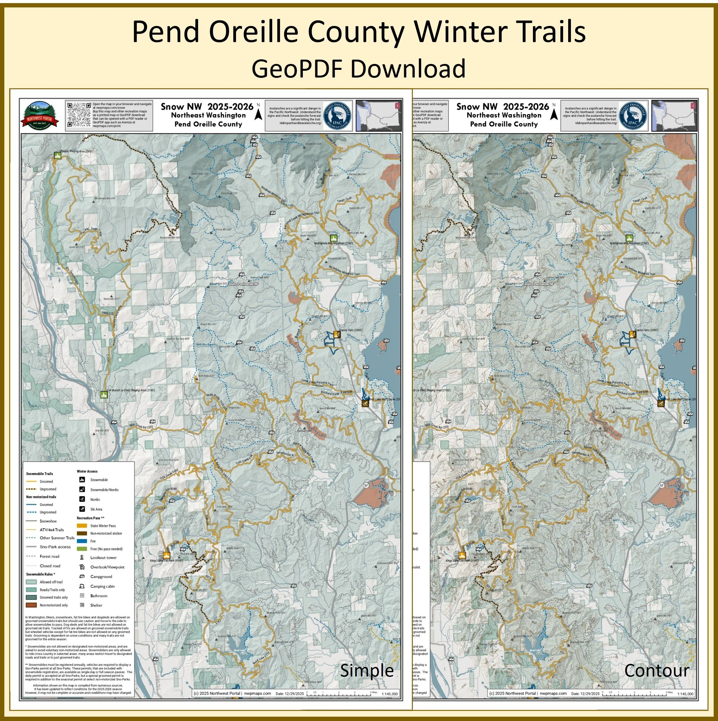 Image 3 of 5
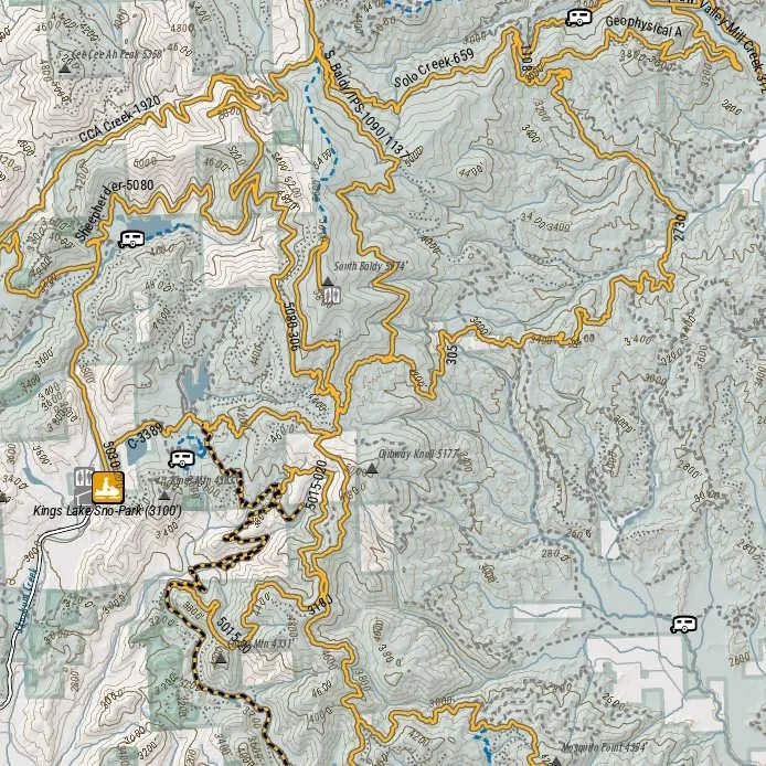 Image 4 of 5
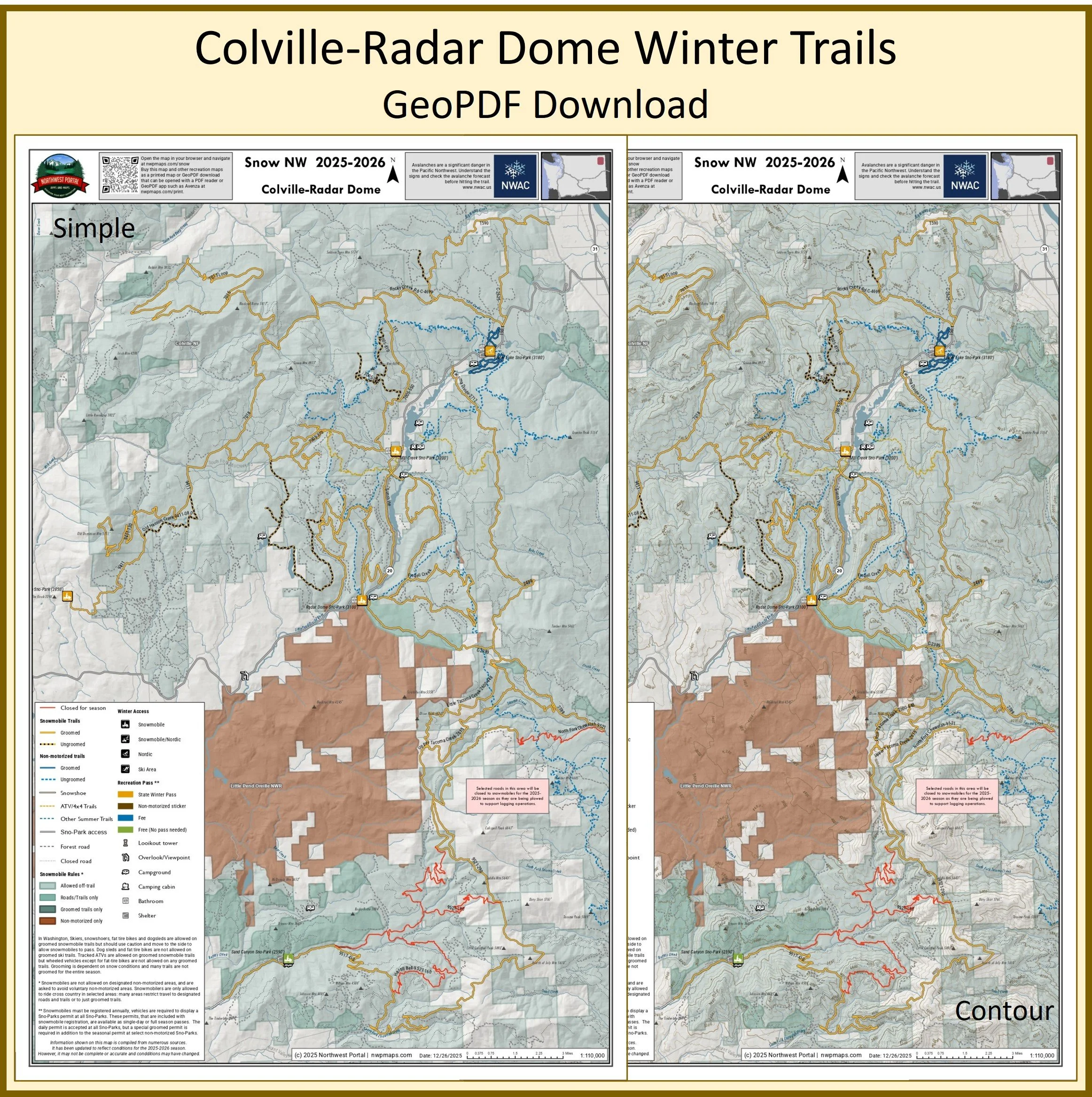 Image 5 of 5
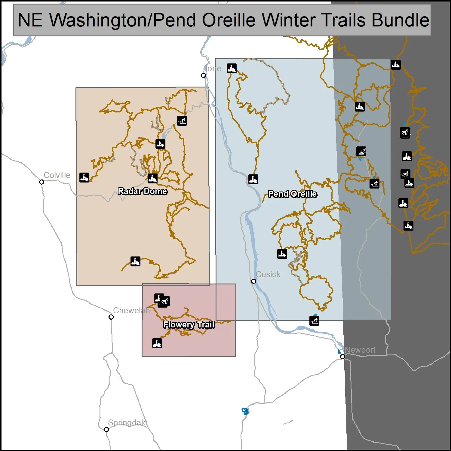
This bundle includes three maps of winter trails in Northeast, Washington: Radar Dome (1:110,000), Flowery Trail/49 degrees North (1:60,000) and Pend Oreille (1:145,000).. It is part of a series of winter recreation map that show where you can ride your sled, ski or snowshoe in the Pacific Northwest. See which trails are groomed, what areas snowmobiles are allowed and where they are restricted. The maps, which were updated for the 2025-2026 season, include shelters, campgrounds, viewpoints, fire towers as well as summer trails and recreation roads, that are often utilized for winter recreation, campgrounds. The maps are tabloid sized (11x17”) PDFs that you can print or use with a GeoPDF app such as Avenza. You will receive two versions of each map, one with contour lines and one without.
This bundle includes three maps of winter trails in Northeast, Washington: Radar Dome (1:110,000), Flowery Trail/49 degrees North (1:60,000) and Pend Oreille (1:145,000).. It is part of a series of winter recreation map that show where you can ride your sled, ski or snowshoe in the Pacific Northwest. See which trails are groomed, what areas snowmobiles are allowed and where they are restricted. The maps, which were updated for the 2025-2026 season, include shelters, campgrounds, viewpoints, fire towers as well as summer trails and recreation roads, that are often utilized for winter recreation, campgrounds. The maps are tabloid sized (11x17”) PDFs that you can print or use with a GeoPDF app such as Avenza. You will receive two versions of each map, one with contour lines and one without.