This pair of maps shows winter trails in Oregon's Wallowa-Whitman National Forest that are groomed by the Panhandle Snowmobile Club East. It is part of a series of winter recreation map that show where you can ride your sled, ski or snowshoe in the Pacific Northwest. See which trails are groomed, what areas snowmobiles are allowed and where they are restricted. The maps, which were updated for the 2025-2026 season, include shelters, campgrounds, viewpoints, fire towers as well as summer trails and recreation roads, that are often utilized for winter recreation. The east map, at a scale of 1:90,000, shows trails out of Clear Creek Sno0Park in Baker and Wallowa County. The west map, at a scale of 1:130,000, has trails out of Catherin Summit Sno-Park in Union and Baker Counties. The map is a tabloid sized (11x17”) PDF that you can print or use with a GeoPDF app such as Avenza. You will receive two versions of the map, one with contour lines and one without.
This pair of maps shows winter trails in Oregon's Wallowa-Whitman National Forest that are groomed by the Panhandle Snowmobile Club East. It is part of a series of winter recreation map that show where you can ride your sled, ski or snowshoe in the Pacific Northwest. See which trails are groomed, what areas snowmobiles are allowed and where they are restricted. The maps, which were updated for the 2025-2026 season, include shelters, campgrounds, viewpoints, fire towers as well as summer trails and recreation roads, that are often utilized for winter recreation. The east map, at a scale of 1:90,000, shows trails out of Clear Creek Sno0Park in Baker and Wallowa County. The west map, at a scale of 1:130,000, has trails out of Catherin Summit Sno-Park in Union and Baker Counties. The map is a tabloid sized (11x17”) PDF that you can print or use with a GeoPDF app such as Avenza. You will receive two versions of the map, one with contour lines and one without.

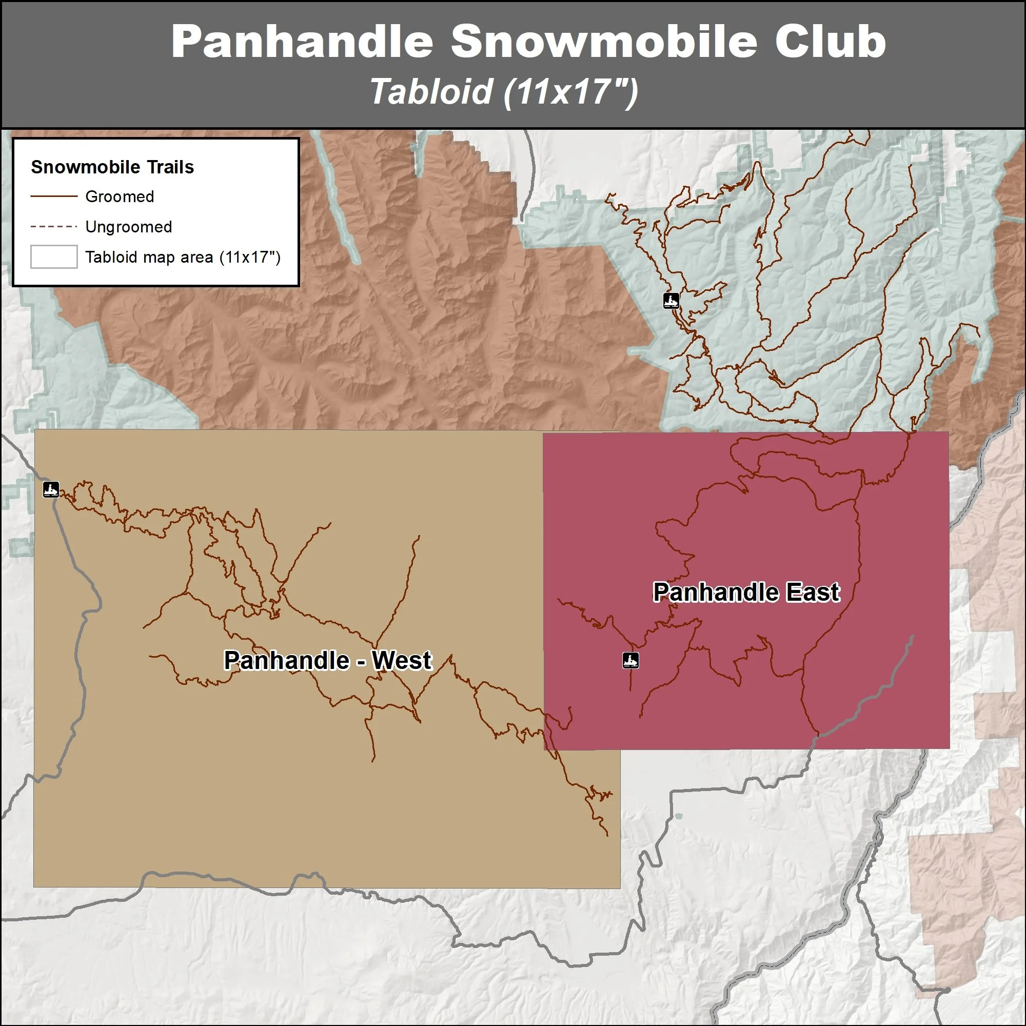 Image 1 of 7
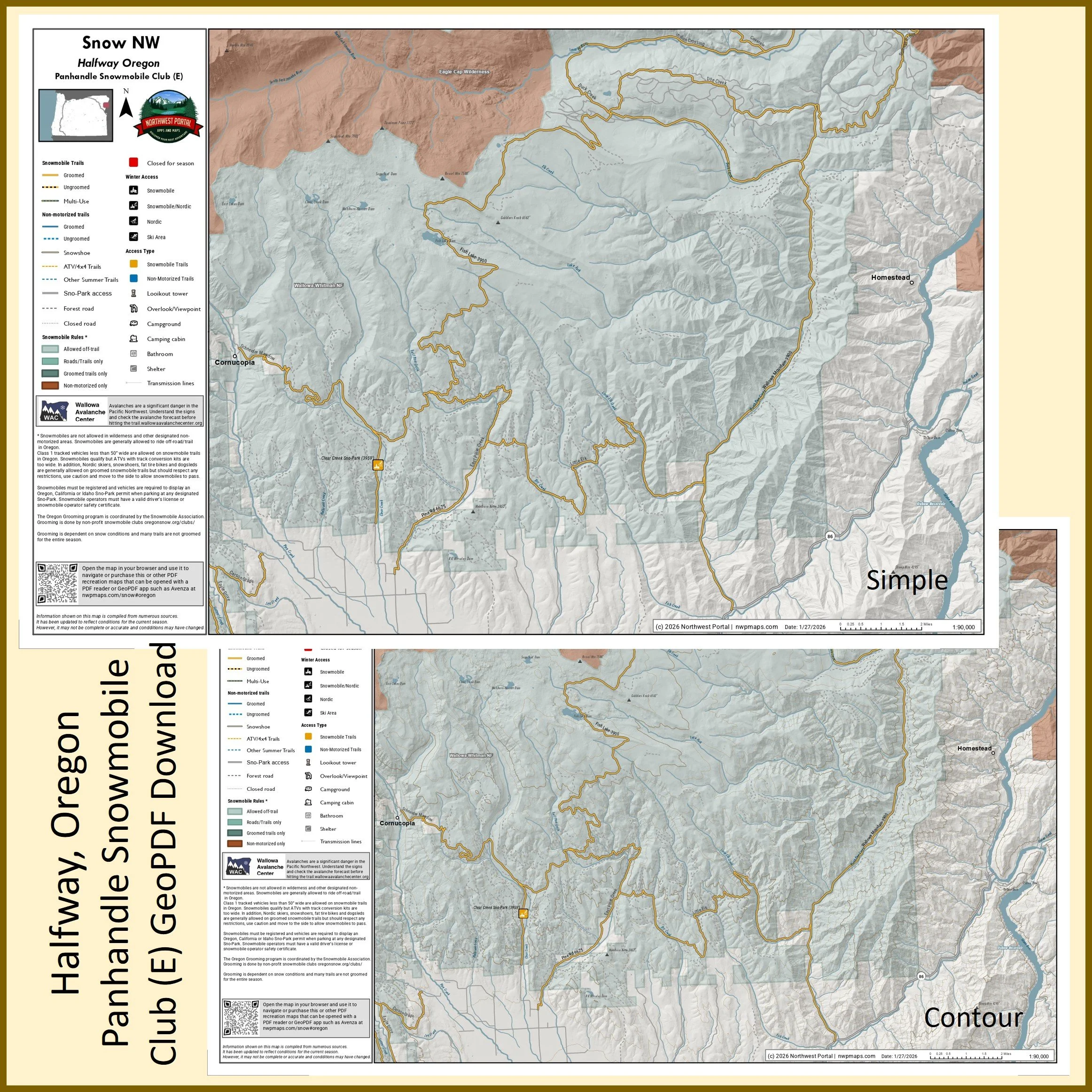 Image 2 of 7
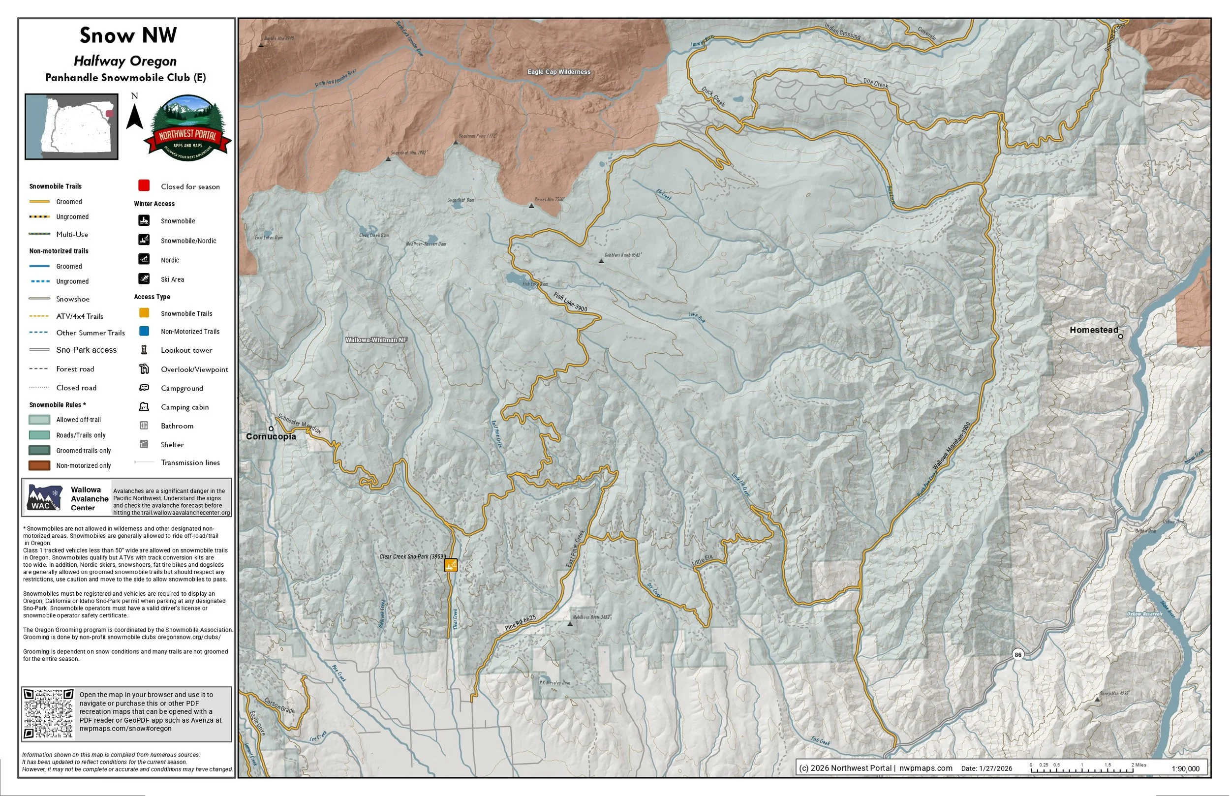 Image 3 of 7
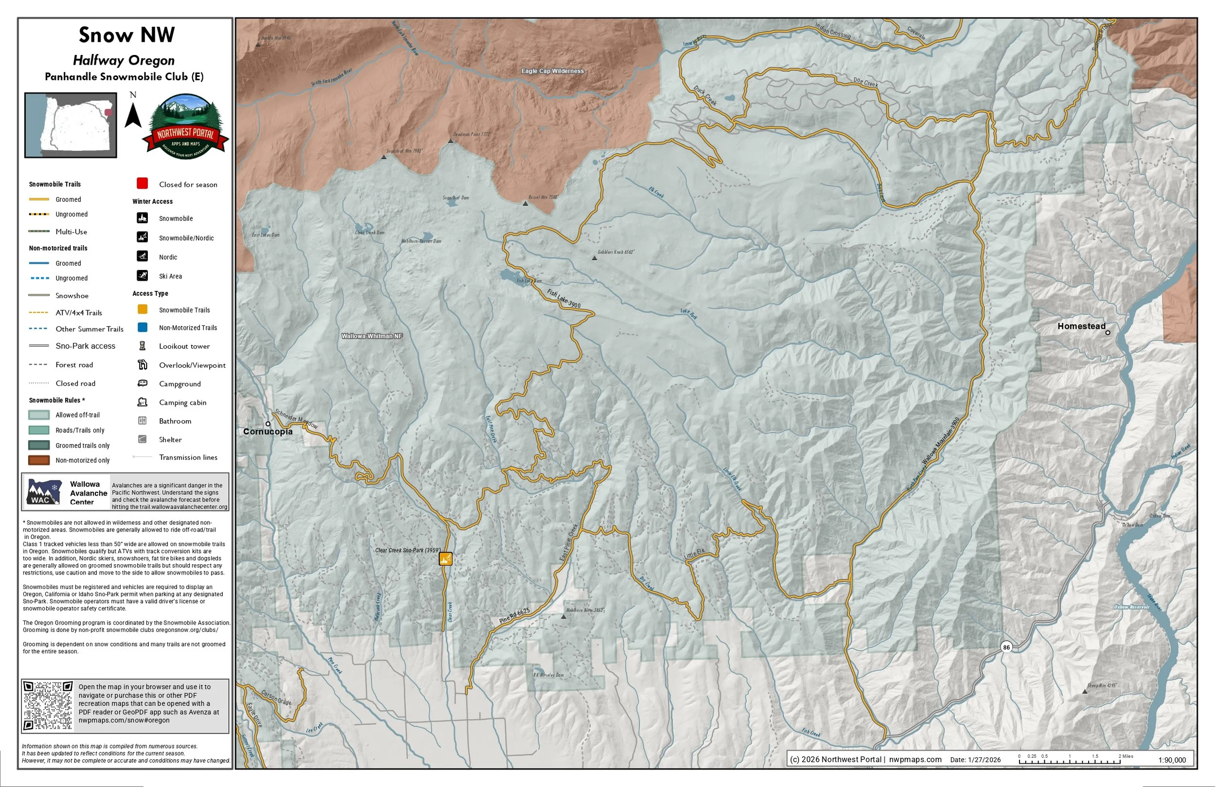 Image 4 of 7
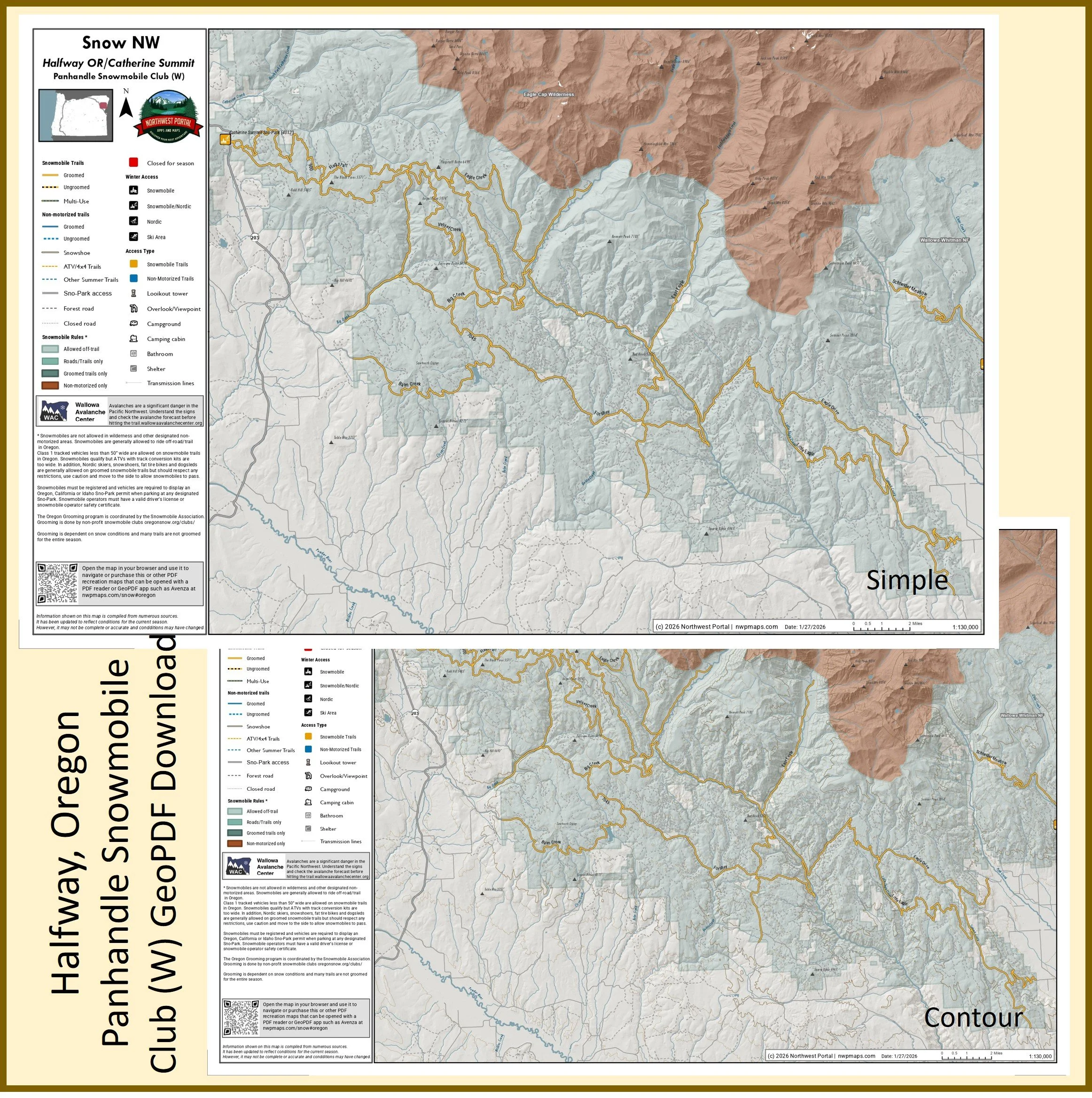 Image 5 of 7
 Image 6 of 7
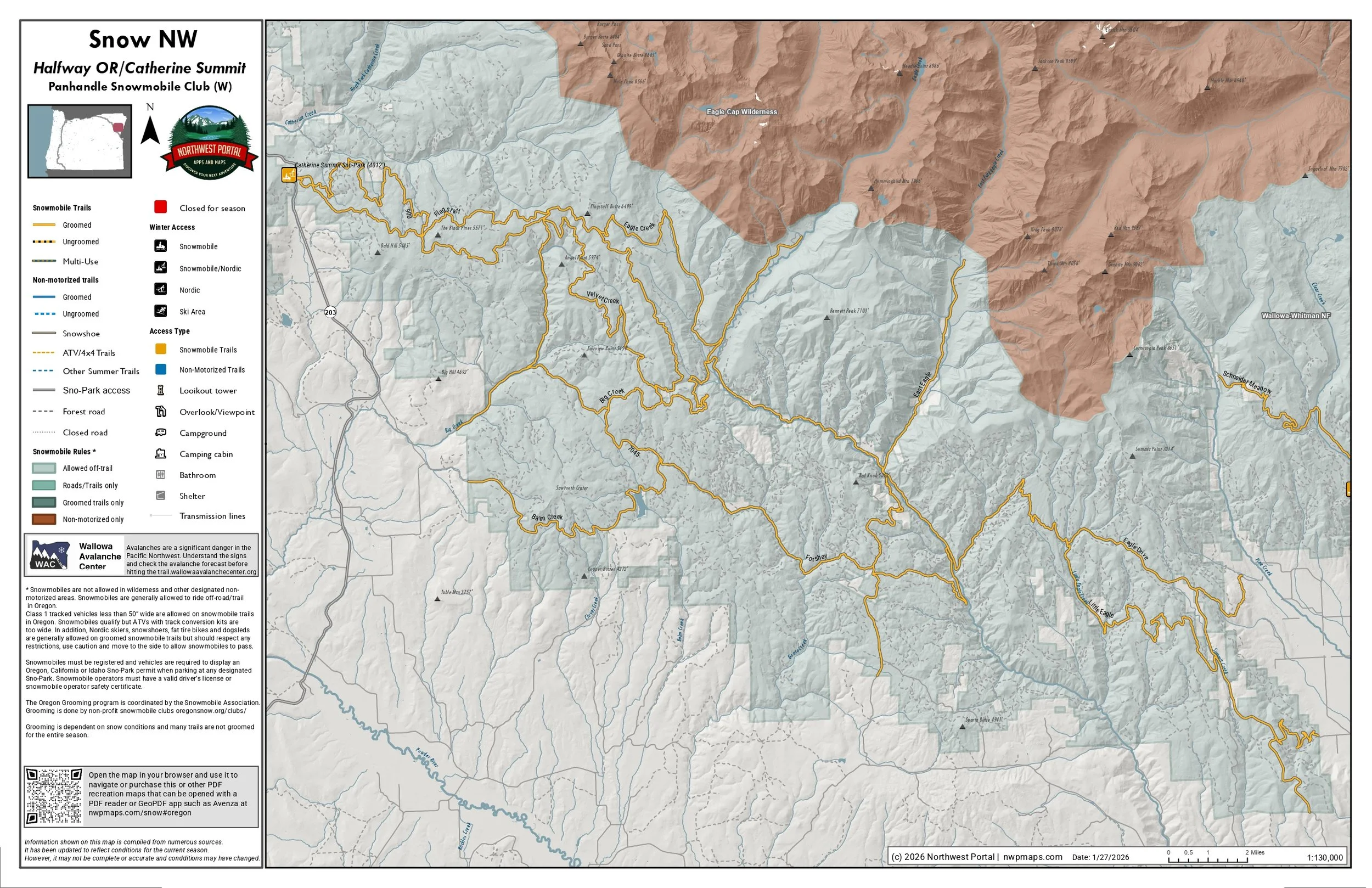 Image 7 of 7