This map shows winter trails in Oregon’s Blue Mountains that are groomed by the Tollgate Trailfinders snowmobile clubs. It is part of a series of winter recreation map that show where you can ride your sled, ski or snowshoe in the Pacific Northwest. See which trails are groomed, what areas snowmobiles are allowed and where they are restricted. The maps, which were updated for the 2025-2026 season, include shelters, campgrounds, viewpoints, fire towers as well as summer trails and recreation roads, that are often utilized for winter recreation. This map shows trails served by Morning Creek, Spout Springs, Woodland, and Andie's Sno-Parks. The map includes areas in Umatilla national Forest in Wallowa and Union County. It is a poster sized (24x36”) PDF at a 1:85,000 scale that you can print or use with a GeoPDF app such as Avenza.
This map shows winter trails in Oregon’s Blue Mountains that are groomed by the Tollgate Trailfinders snowmobile clubs. It is part of a series of winter recreation map that show where you can ride your sled, ski or snowshoe in the Pacific Northwest. See which trails are groomed, what areas snowmobiles are allowed and where they are restricted. The maps, which were updated for the 2025-2026 season, include shelters, campgrounds, viewpoints, fire towers as well as summer trails and recreation roads, that are often utilized for winter recreation. This map shows trails served by Morning Creek, Spout Springs, Woodland, and Andie's Sno-Parks. The map includes areas in Umatilla national Forest in Wallowa and Union County. It is a poster sized (24x36”) PDF at a 1:85,000 scale that you can print or use with a GeoPDF app such as Avenza.

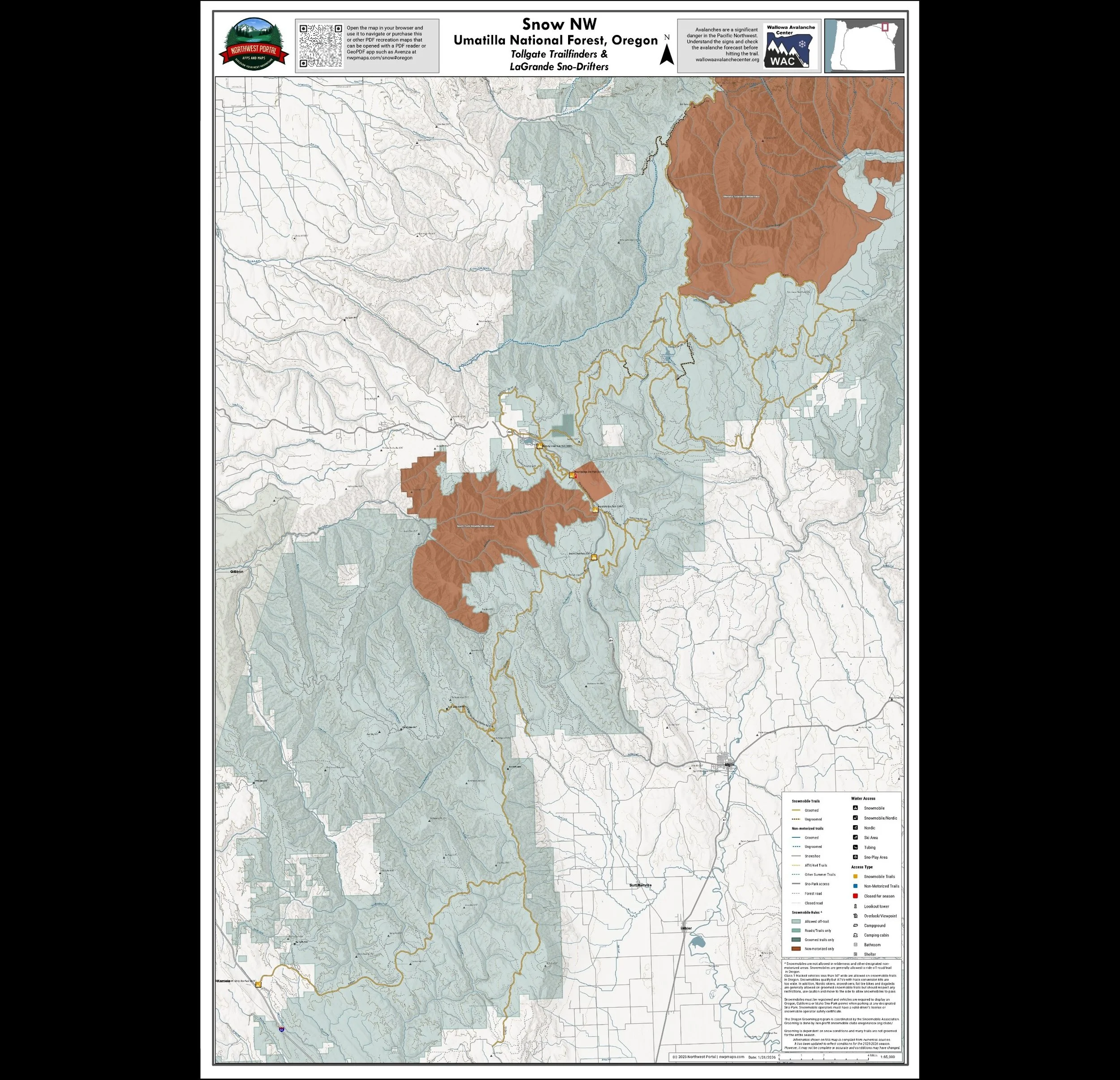 Image 1 of 6
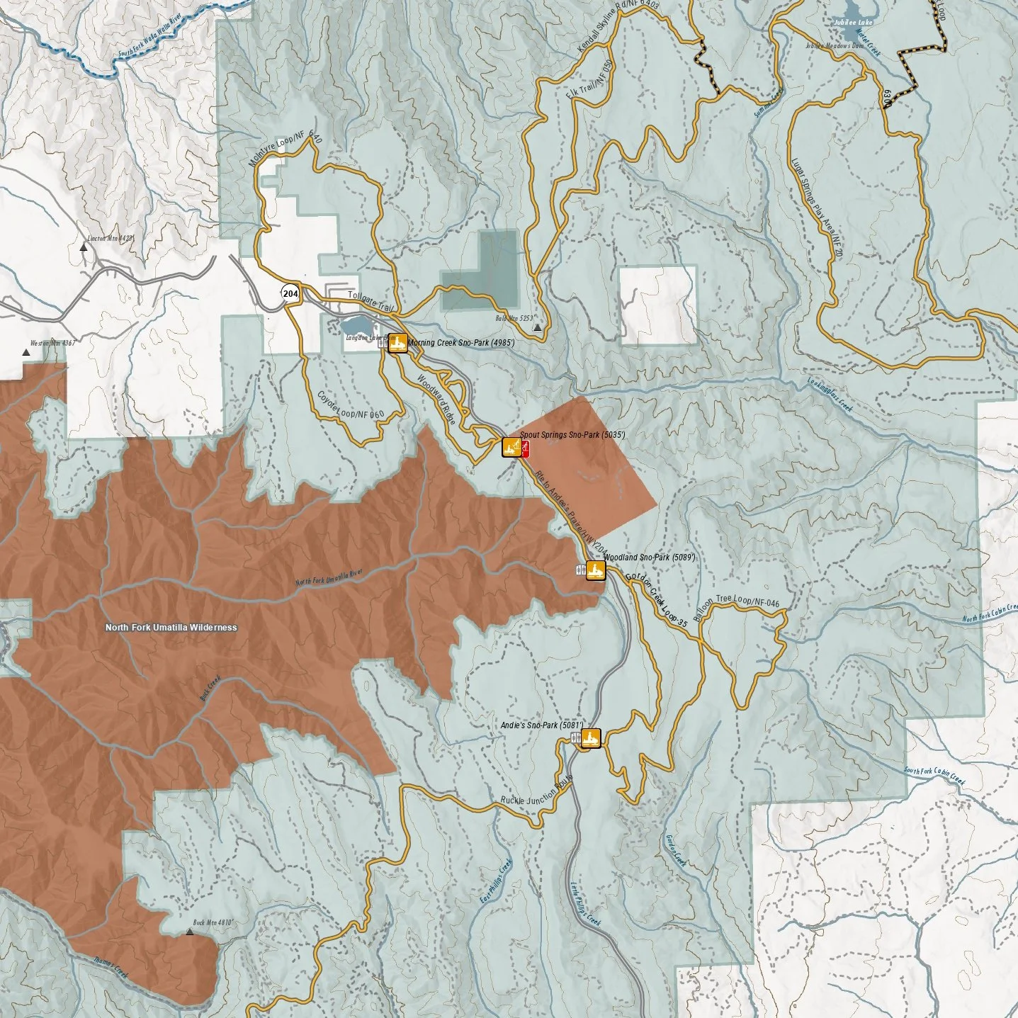 Image 2 of 6
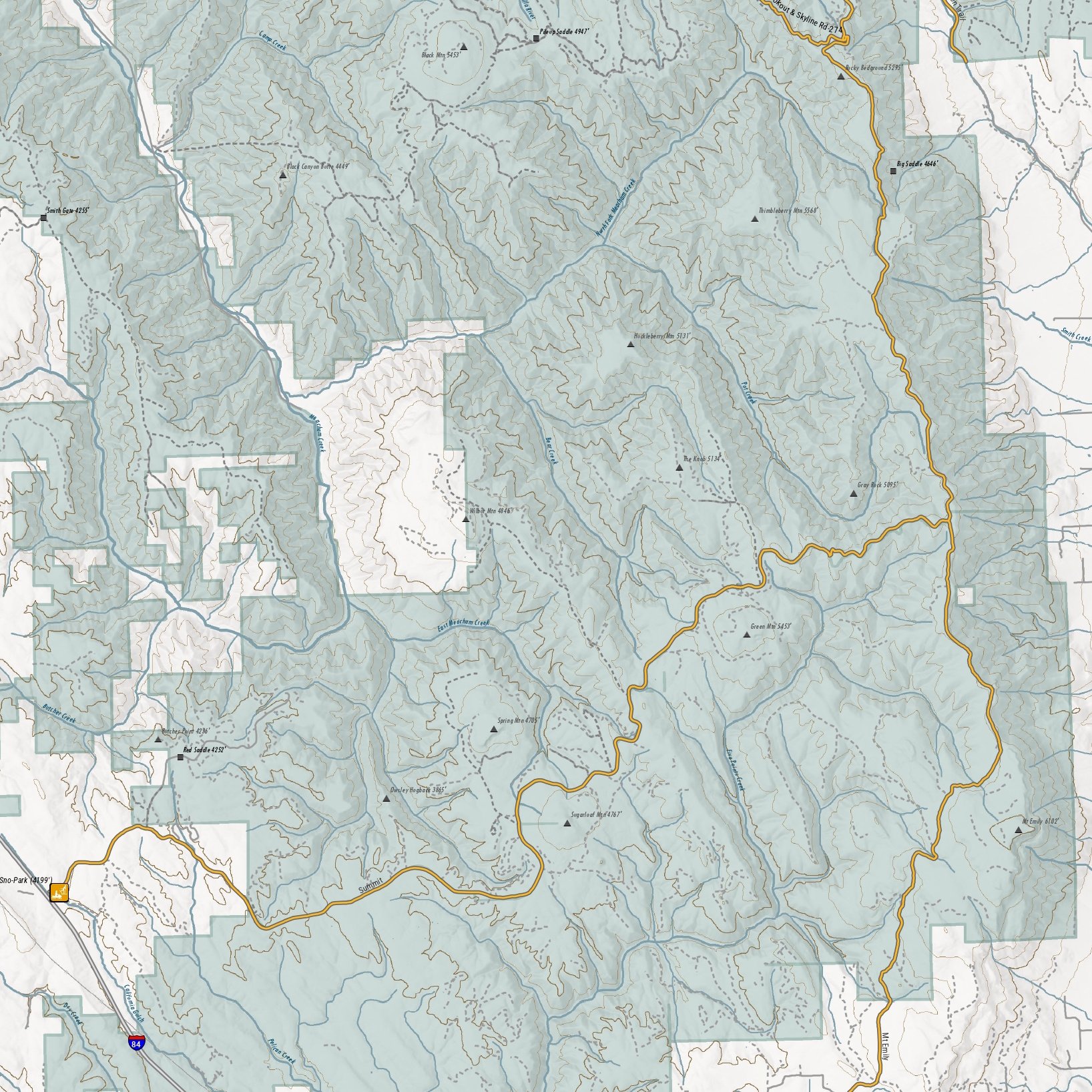 Image 3 of 6
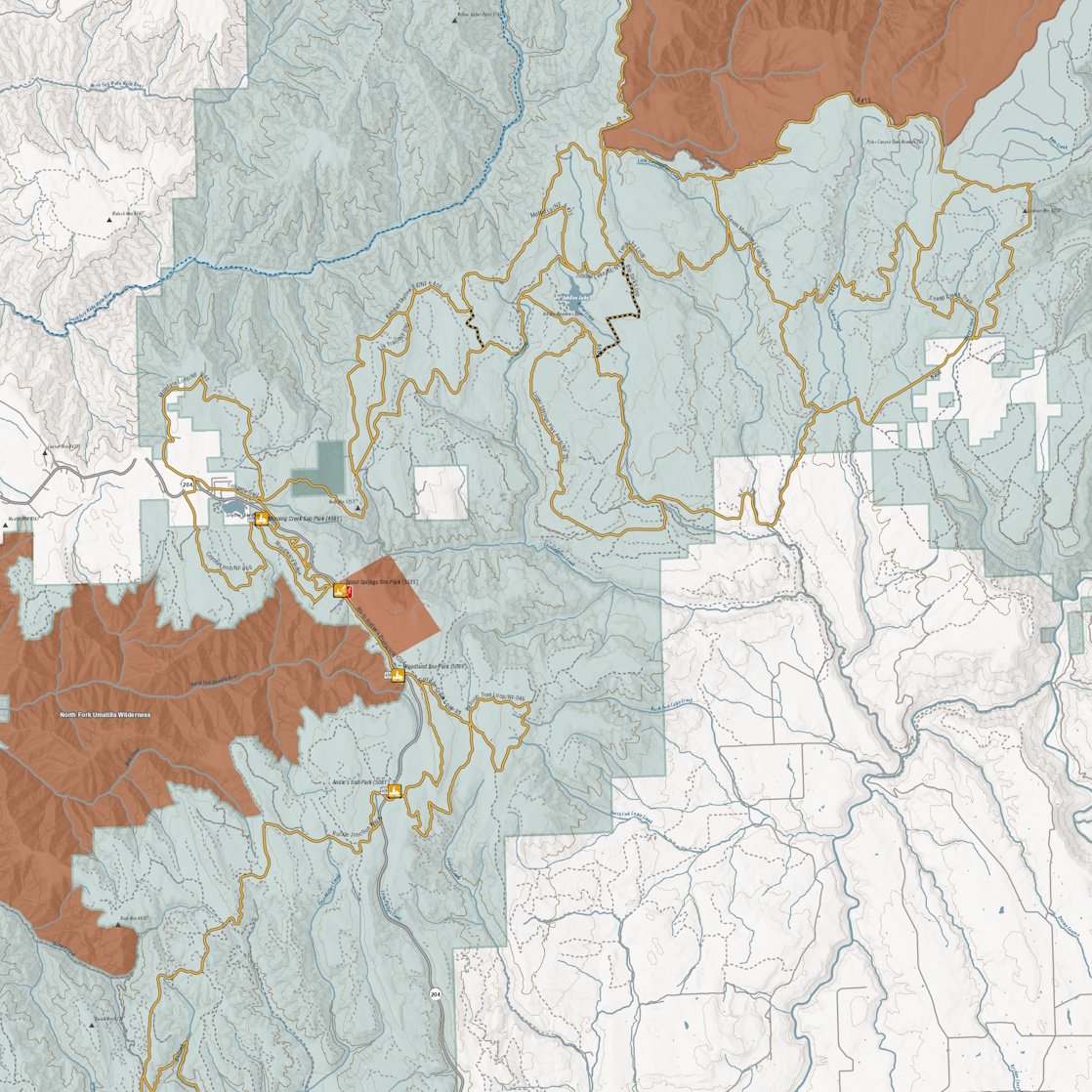 Image 4 of 6
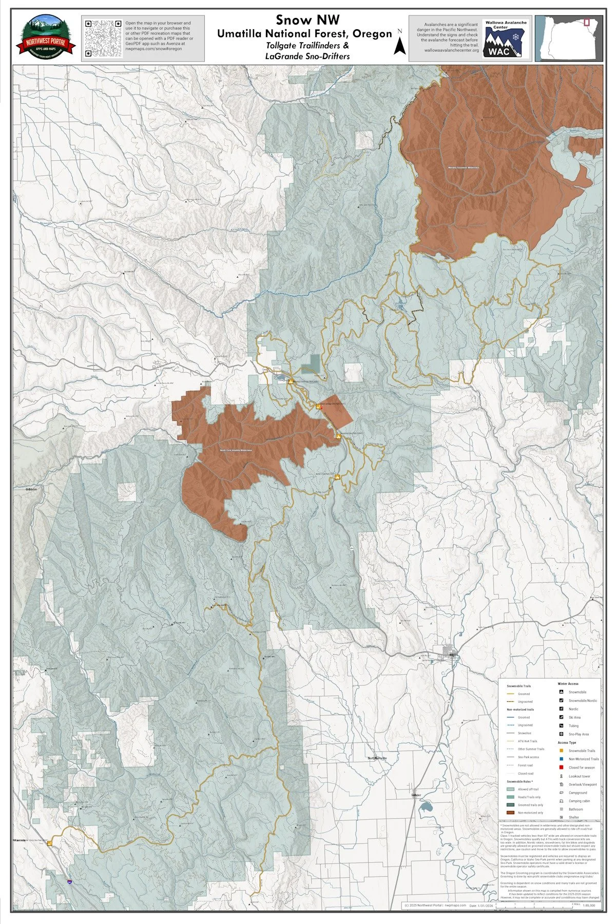 Image 5 of 6
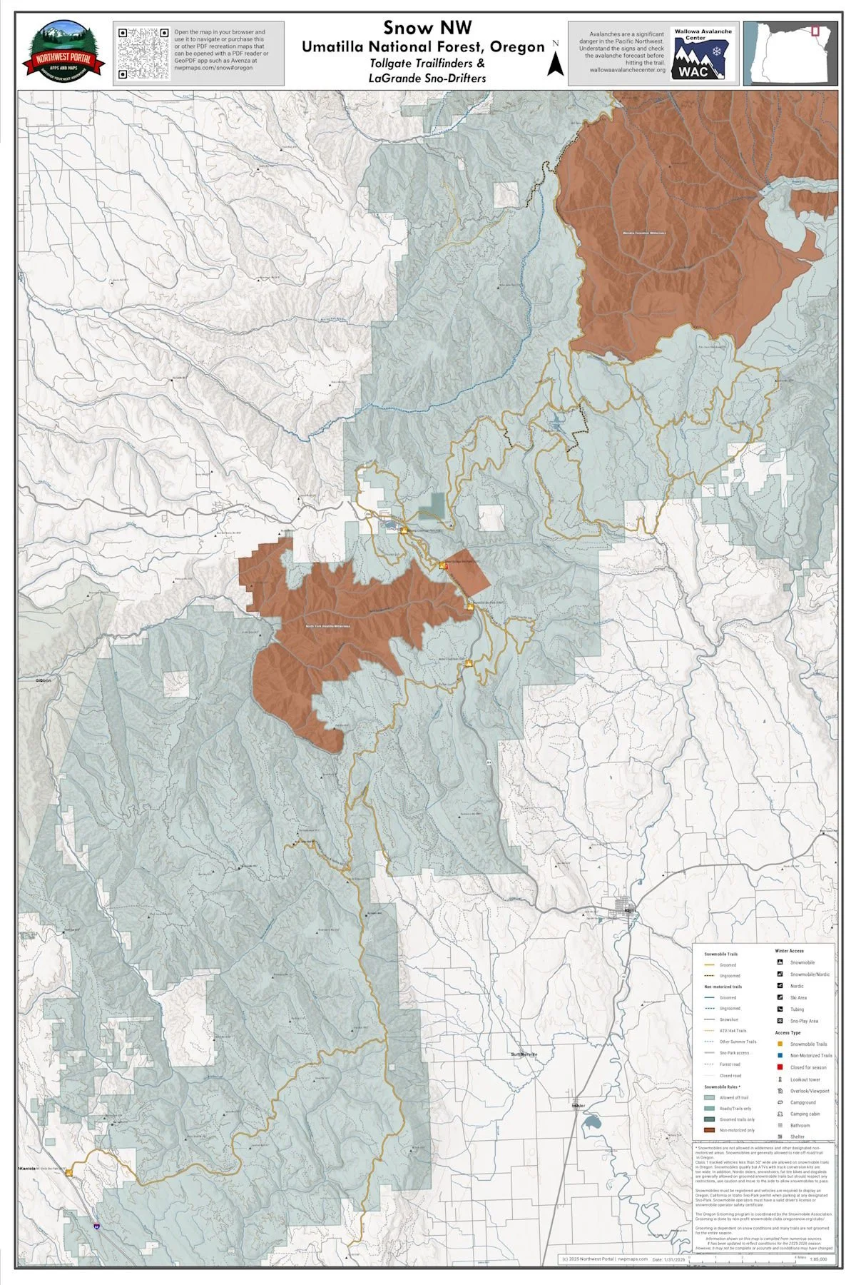 Image 6 of 6