
 Image 1 of 4
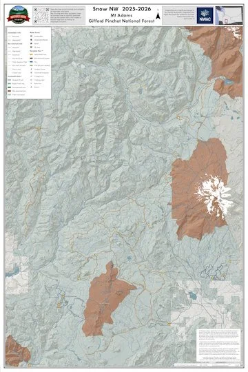 Image 2 of 4
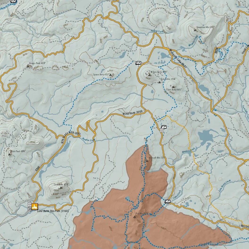 Image 3 of 4
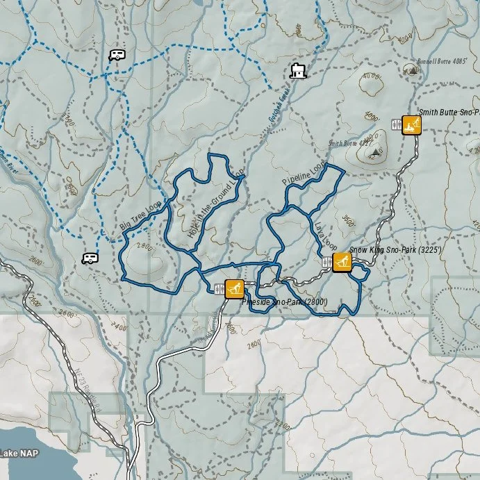 Image 4 of 4
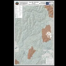
This map of the winter trails in the Mount Adams Area of Gifford Pinchot National Forest, Skamania County, Washington is part of a series of winter recreation map that show where you can ride your sled, ski, dogsled or snowshoe in the Pacific Northwest. See which trails are groomed, what areas snowmobiles are allowed and where they are restricted. The map, which was updated for the 2025-2026 season, include shelters, campgrounds, viewpoints, fire towers as well as summer trails and recreation roads, that are often utilized for winter recreation, campgrounds. It is a poster sized sized (24x36”) GeoPDF at a 1:85,000 scale that you can print, view in your browser or use with a GeoPDF app such as AvenzaThe map also shows 4x4 and other summer trails and recreation roads to assist in navigation. Public lands are color coded to show where users can ride off-road/trail, where they must stay on trail and areas where snowmobiles are not allowed. The map includes trails out of Johnson Creek, Marble Mountain, Wakepish, Curley Creek, Lone Butte, Orr Creek, Flattop and Atkisson Sno-Parks as well as the Nordic and snowshoe trails from McClellan Meadows, Oldman, Pineside and Snow King Sno-Parks.
This map of the winter trails in the Mount Adams Area of Gifford Pinchot National Forest, Skamania County, Washington is part of a series of winter recreation map that show where you can ride your sled, ski, dogsled or snowshoe in the Pacific Northwest. See which trails are groomed, what areas snowmobiles are allowed and where they are restricted. The map, which was updated for the 2025-2026 season, include shelters, campgrounds, viewpoints, fire towers as well as summer trails and recreation roads, that are often utilized for winter recreation, campgrounds. It is a poster sized sized (24x36”) GeoPDF at a 1:85,000 scale that you can print, view in your browser or use with a GeoPDF app such as AvenzaThe map also shows 4x4 and other summer trails and recreation roads to assist in navigation. Public lands are color coded to show where users can ride off-road/trail, where they must stay on trail and areas where snowmobiles are not allowed. The map includes trails out of Johnson Creek, Marble Mountain, Wakepish, Curley Creek, Lone Butte, Orr Creek, Flattop and Atkisson Sno-Parks as well as the Nordic and snowshoe trails from McClellan Meadows, Oldman, Pineside and Snow King Sno-Parks.